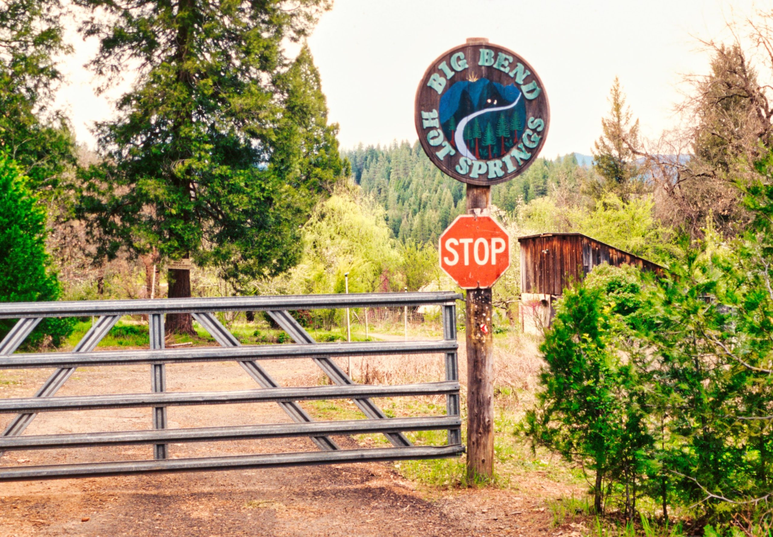
Big Bend and Big Bend Hot Springs History
A Work In Progress!
We are researching and collecting the history of the Big Bend Hot Springs area. Please let us know if you have additions and/or corrections to this long and complex story…
THANKS to all who have contributed to this collection of words from a variety of sources.
—————————————————————
Overview of Some Prehistoric and Historic Events and Periods:
Approximately 200 AD: New technology, the bow and arrow, is introduced into the Madesi Pit River area.
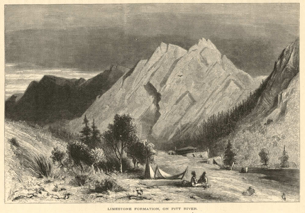
Pre-1800 – Madesi band of indigenous natives were living in abundance for thousands of years. Big Bend and the surrounding country are the ancestral territory and home of the Madessawi people. (also Madesi, pronounced Mah-Day-See) For thousands of years, numerous Madesi villages were situated around the valley and along Achoma (the Pit River) and out onto the hills and mountains that define the eleven-mile wide round valley. The Madesi utilized the natural resources of their land to the fullest. In addition to harvesting deer, salmon, trout, rabbit, birds, and other small mammals, they often moved around their territory and gathered acorns, roots, herbs, and fruits, as each came into their season.
Before the European-American invasion, the Native Americans of the Pit River region were thriving. The Madesi band (part of what some call the “Achomawi language group”), who lived in the Big Bend area, were one of eleven bands in the region that now are in the “Pit River Tribe”. The Madesi apparently often lived in pit houses in small familial villages along Achoma (aka, the Pit River). They apparently moved around their territory, following opportunities to harvest foods from the rich resources of the valley, and apparently moved to higher ground when the creeks and rivers flooded in the rainy season. Archaeological evidence and some information collected by ethnographers in the early 1900’s gives only minimal details of the thriving culture and communities that existed in what is now known as Big Bend and the surrounding areas.
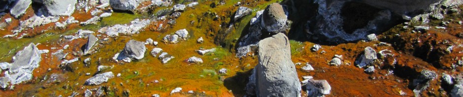
Several Madesi villages in the vicinity of the hot springs have been identified in the few existing ethnography reports: “Oo-le-moo-me,” (NW corner of BBHS property, South side of river, East of Ano-che-che (aka, Kosk Creek), near the “beach” and the lower hot springs, . The main hot spring (aka, the “Mother Source”) and the area around the confluence of “Indian Springs Creek” with Achoma (or the Pit River) was said to be the Madesi village of “Lah-lah-pis-mah.” Big Bend Hot Springs was also apparently called “Dirl’ploha” by some other tribes in the region.
Across the river from Lah-lah-pis-mah, was the main, or head village of the Madesi, called “Madess,” or “Madess-Atjwam,” (translates to Madess Valley or Madess Flat). Just upriver from Lah-lah-pis-mah (on the South bank of the river) was the tiny village of “Alosatcha,” possibly located behind today’s Big Bend Community Club. Further upstream from BBHS several more villages existed along the river, extending around the southern base of Chalk Mountain, such as “Tah-Sah,” on the sandy flat where the Pit Stop Store now stands, and “Ah-lis-chu-chah” on the North side of the river, west of Nelson Creek (the creek itself was also apparently called Ah-lis-chu-chah).
Madesi and Pit River Bands Reverence for Nature
A continuing reverence for the land and water has been noted by virtually every researcher in Pit River territory. In the 1870s, Powers stated that “they are not content with designating the river as a whole, but every reach, every cataract, every bend, has a name to itself” (Powers 1976). The researcher and writer de Angulo remarked upon the “extremely intimate contact” with nature characteristic of the Pit River people in the 1920s. In 1928, Merriam wrote: “The Pit River Indians have lived so close to nature for so many thousands of years, and have been on such intimate terms with nature, that they in their minds form a part of nature. They see in their environment, not only what we see, but much more- for they endow animals with attributes and reason similar to their own and recognize in them a kinship of activities, relationships, and powers…”
In the 1970s, Olmsted wrote that “Pride in the knowledge of the extent and resources of their aboriginal home territory is matched only by Achumawi self-esteem for successful survival in their homeland….” In spite of the many disruptions in the last 150 years, band-specific ties to the land and its waters remain. It is important to note that Pit River people draw no distinction between prehistoric, historic, and current use, stressing rather their continuous association with the land.
To make tools, the Madesi apparently used basalt, other kinds of rocks, and lots of obsidian from Glass Mountain. Obsidian arrowheads and obsidian flakes from tool-making have been found all over the valley from the river banks to the hillsides and high in mountain hunting camp areas. One story that was reported is that local Madesi youth jumped off a steep river bank cliff (into a pool in the river below), near the main hot spring, as a rite of passage ritual… Due to being in a remote mountain valley in Northern California, and off of any main transportation routes, the Madesi had a relatively undisturbed existence well into the nineteenth century. They were apparently one of the last tribes in the USA to be invaded and pushed out of their home land.
1815 – Russian explorers were said to be the first white men in Shasta County (it is unknown if they passed through Pit River area, or not)
1827-1830’s – European-American/Canadian fur trappers and explorers began passing through the Pit River area (unknown if they made it to the Madesi Valley or not).
1832 – Many Shasta County and Pit River natives reportedly died from imported diseases (unknown if it effected the Big Bend area)(?)
1840’s – Madesi territory was still relatively undisturbed and had only been visited by a handful of foreigners briefly passing through.
1848 – California became part of U.S.A. through treaty with Mexico (in 1850 California became a state). The territory of the Madesi and other Pit River tribes was stolen from them, as colonizers spread out throughout the region.
1851-53 – U.S. Congress and California Legislature created various laws that deny Indians of land rights and effectively extinguished all aboriginal title in the state, paving the way for more continued genocide and land theft, with no treaties or protections for Indians.
————————————-
Lah-lah-pis-mah and Other Madesi Villages Become Big Bend
A Sad Story of Genocidal Invasion
The movement of white emigrants into Madesi territory (started in the 1860‘s and 1870’s) caused more and more Madesi displacement and changes to the environment. The emigrants often had no respect for the delicate balance of nature, grazing their cattle and horses in prime hunting and gathering areas. A steady flow of emigrants arrived determined to occupy Madesi land without any respect for the local people already living there, and began the process of confiscating and fencing off the land.
By 1868 the US Army under General George Crook brutally took control of many upriver Achoma areas. When and if Crook’s forces came to Big Bend is uncertain. A story of a massacre of Madesi villagers along the river has been handed down, but the year is unclear. Were the Big Bend Madesi massacres in the 1860s? 1870’s? 1880’s? Seems like it must have been some time in that 30 year period, when there were fewer and fewer Madesi and more and more white settlers changing Big Bend forever.
The Madesi area also underwent some kinds of impacts not common for the region as a whole. At Big Bend, the hot springs had drawn Yana, Wintu, and Pit River people to their waters. In the historic era, they were taken over by white settlers, who turned the area into a “resort”. Access to this place of healing now was dependent upon the whim of the current landowner.
The Madesi area was also somewhat unique in the amount of impacts on lands remote from settlements. Government timber land went on sale in 1878, and allowed the purchase of up to 160 acres at $2.50 an acre. Outlying areas were victim to a speculative boom as a result, and large acreages passed into private hands. The area was subsequently heavily logged. The super intense ecosystem-destroying over-harvesting of timber in Big Bend region remains a huge problem today. Most of the once vast and diverse forests in the area have been abused, destroyed, and changed into unhealthy tree farms by clear-cutting and other industrial logging practices.
The occupation of the valley areas by whites, disrupted the safety of the Madesi and their traditional food supply. Many Madesi were displaced against their will, some brutally murdered, in these years. Some returned or resettled nearby when they could, but countless people were cut off from their extended families and their traditional food sources. Into the 1900’s, many Madesi survived in poverty and some were hired out as ranch hands, mill workers, forestry workers, etc… The brutal arrival of white emigrants forever altered the environment and culture of the Madesi people.
The Madesi people never signed a treaty with the United States or the Sate of California; their land was simply illegally confiscated. Today, the Madesi have survived and continue to live in what is now called Shasta County, as well as throughout the West. Some continue to hunt and gather in their traditional places, and pray at their sacred sites throughout their homeland. Today, they are federally recognized indians and one of eleven bands making up the Pit River Nation.
1847– Spanish Mining Camp in Big Bend. Spaniards looking for minerals searched up all the creeks.
1850’s – European-American immigrant expansion interest and activity in Pit River region began. USA government, military forces, and settlers invaded, attacked, displaced, and killed the majority of Pit River Indians (including the Madesi and ten other regional bands), with no treaties or compensation made for land seized.
Regionally (intensifying in the mid 1850’s), the European invaders ruthlessly and tragically destroyed most of the Pit River natives, and their way of life. The Madesi (and virtually all California indigenous bands) were repeatedly abused, killed, and brutally massacred, as the invaders raided village after village in countless incidents, including some more well-known battles, such as the “Wintoon War” and the “Pit River War”…
Here is one account of some of those ruthless attacks: “War was declared on the Indians in 1858. General William Kibbe and Captain I. G. Messec led military and civilian soldiers against the Indians from Trinity County all the way to the Fall River Valley. These soldiers were known as Kibbe’s Guards and were ruthless, efficient Indian killers.”
Many Indians surrendered under the threat of death or starvation, others were captured, untold numbers were killed, and their villages and food supplies were destroyed in the battles.
In 1859, 700 captured Pit River Indians were forcibly taken to the Round Valley Reservation in Mendocino County for internment. The number of soldiers reported killed in the attacks varies; one account mentions 25, while another mentions 90. The main genocidal “war” ended in 1859. Although the vast majority of Pit River Indians had been killed or forcibly moved out of the area, some remained, hidden away, and over 500 of those who were sent away eventually returned to their homeland, only to find white settlers unlawfully taking over more and more property.
1860 – First white settlers began coming into Big Bend area.
1878 – Government begins selling off stolen lands to white settlers. Government timber land went on sale in 1878, and allowed the purchase of up to 160 acres at $2.50 an acre. Outlying areas were victim to a speculative boom as a result, and large acreages passed into private hands. The area was subsequently heavily logged.
When the hot springs in Big Bend were discovered by some of the invasive non-native occupiers (also known as European-American “settlers”) in the 1890s they apparently moved in and started building what eventually became a small town of white settlers. The town was said to be called “Elena,” in 1890 (after Elena Haggen, the area’s first white womon settler) but later was renamed “Henderson,” (after a dominant settler family in the area), and then renamed again, “Big Bend.” Also, in 1890 a ferry across the Pit River in Big Bend was started, apparently where the Madesi village of Tah-sah used to be, and where the Pit Stop Store and Big Bend bridge now sits.
From a Redding periodical:
“In the early 1890’s it was discovered that the sulphur hot springs in Big Bend had healing powers, both from bathing and drinking. The news spread fast and many rheumatics and sick people rushed in the year around for relief. The rush is still on. Many have been healed or greatly helped by these waters.”
-From “Early History of Big Bend,” by Leslie B. Ralston. The Covered Wagon, 1949
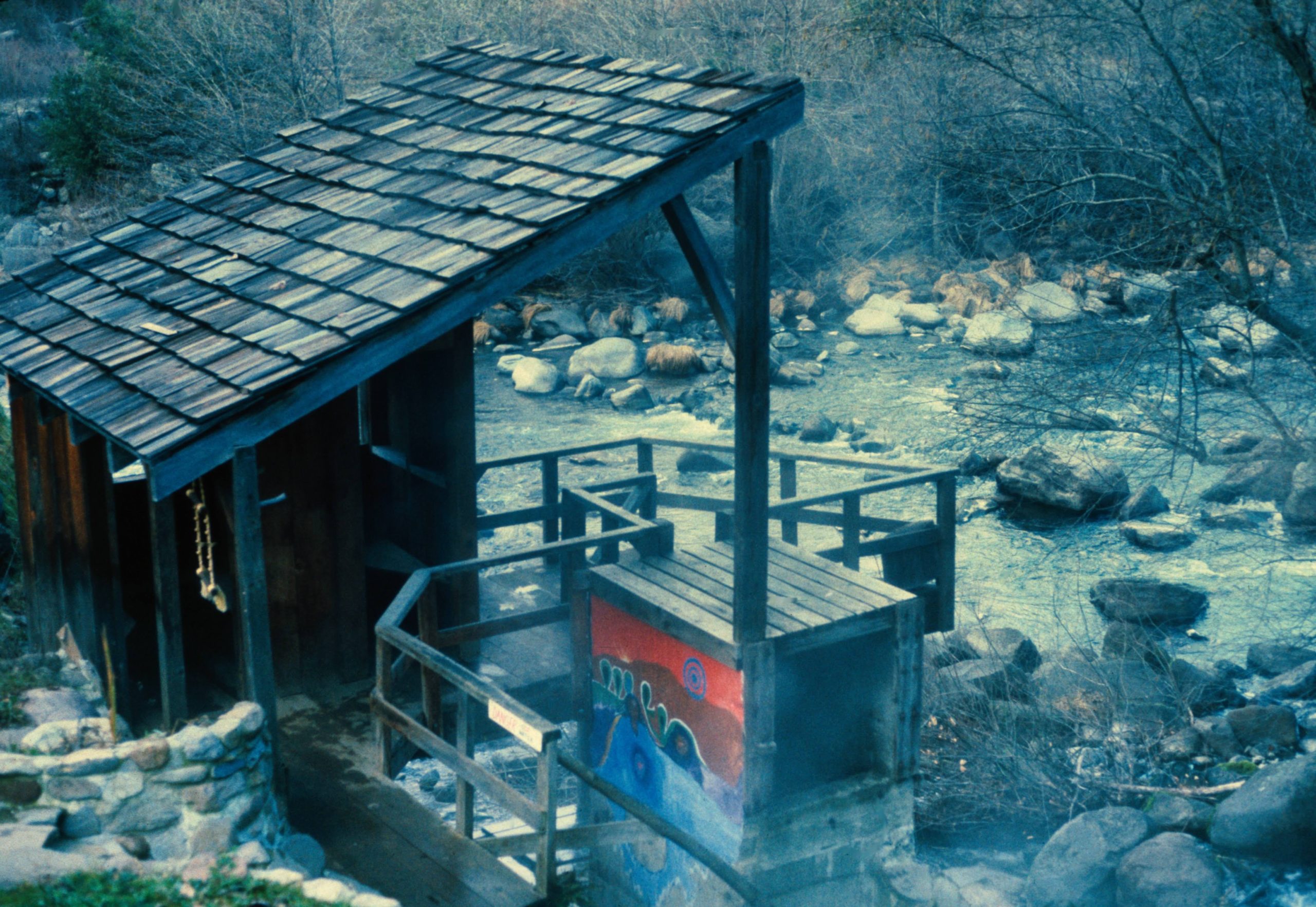
One early account stated: “The hot water bubbled up between the rocks into a natural pool big enough for three people at the upper end. From there the hot water emptied down an incline into the Pit River. Cold water was brought to this pool in a wooden flume from a natural spring to make the water comfortable for bathing and relaxing.”
1900 Big Bend Lumber Company opened a mill in Big Bend and hired some of the last remaining Madesi natives living in the area as mill workers.

In 1901, a correspondent of the Anderson News reported 25 camps and 80 people crowded the Big Bend Hot Springs. The place was beginning to resemble a town with a photo gallery, an ice cream/candy stand, and violin and guitar music every night. Talk was to build two or three bath houses to accommodate the crowds.
1903: Shasta County records lists a “(30 x 14) cabin built out of Fir with board and batton.”
In approximately 1906:, the springs became a small resort. A hotel, cabins, and a bathhouse were built. The pathway down to the springs was made wider and now included a seat to stop and rest at the halfway point. Bridges were built across the gullies to encourage strolls. Modern conveniences were everywhere for the guests. And with the modern conveniences came a fee for the first time. Also, the log cabin hotel at Big Bend Hot Springs reportedly burned down in 1906.
May 1906 – James Carney, an Irish American white water river log driver, walked to Big Bend from Redding with his friend, Dan Mahoney, to work for the Big Bend Lumber Company, driving logs down the Achoma (Pit River), as they floated down to the Turtle Bay Mill, in Redding. Carney settled in Big Bend and wrote the following story of Mahoney’s night at a dance at the Big Bend Hot Springs (Eight miles from the logging and log driver camp)…
“I never saw so many saddle horses tied up around a dance platform in all me life. There is a wonderful hot springs there right long side the river, lots of little ranches everywhere. Cow punches galore, squaw men, plenty of them quarter breed girls, half breeds, and red-headed white girls all dancen on the same floor, fidel, bago, and getar, and me the only river driver there. Old Jin Pole takes a bath and goes to bed. Sure I danced all night long till after day lite. Ladies choise every other dance and a saloon not a stones thro from the dance. After the dance at the saloon, all those cow punchers wanted to lick me. Well I had a hell of a time knocking them all down. They would get up and come back for more. Finely I got them all in a pile and they started spuring and gougen one an other. I tried to jump clean over all of them but one fellow caught his mouth on my heel and I had a hell of a time kicken him loose. Finally some one hollers hoofs horns and bing holes, and the fight was all over…”
1906 – 1916: Many Pit River tribal members were given land allotments, most of which proved to be disastrous for communities, since they were given some of the worst lands, communities and families were divided up, and many allotments were subsequently sold, (leaving many native people landless).

This rare book is the only known source of some of the Madesi Valley place names.
1907 – 1927: C. Hart Merriam, made several trips to Big Bend to study Madesi culture and language, collecting data on the language, place names, creation stories, and the main Madesi villages in Big Bend. He met Istet Woiche, a Madesi elder and tribal historian, who became Merriam’s main contact and teacher of the Madesi language, stories, natural environment, and ways. Merriam published Istet Woiche’s creation stories in a book called “Anakadel”. The Smithsonian Institute also published Merriam’s “The Classification and Distribution and of Pit River Indian Tribes of California”
This rare 1926 book has a color fold-out map of the territories of the Pit River tribes and a chapter on each of the eleven tribes/bands (includes Ajumawi & Atsugewi language groups). Merriam apparently wanted to learn as much as he could about as many native people, culture, wisdom, and tribes as possible, and his particular focus on the Madesi allows us to know at least an approximation of some of their place names, for which we are grateful. Huge amounts of Merriam’s collected information and field notes from interviewing Native Americans from many different tribes remains unpublished and stored in the UC Berkeley library, for adventurous researchers to dig through.
Merriam’s short chapter on the Madesi of Big Bend is limited and of unknown accuracy, but is truly fascinating and remains one of the only publications that lists many area place names for some geographic features and places that might have been otherwise lost. Another visiting white scholar who studied the Achomawi language (and published “Achomawi Dictionary” in 1966) was D.L. Olmstead. If Merriam’s and/or Olmstead’s information is considered legitimate, we now have the Madesi names for several important local places, such as:
Bald Peak (BB): Mah-how-mah-day Ah-ko
Main Village in Big Bend: Mades or Mah-dess
Big Bend Hot Springs: Lah-lah-pis-mah
BB Madesi village on SE side of Chalk Mt. S side of Pit: Do’lmaahisti
BB Madesi village on SE side of Chalk Mt. S side of Pit: Dimali’mchaboi
BB Madesi village on SE side of Chalk Mt. N side of Pit: Kla’sika
BB Madesi village on SE side of Chalk Mt. N side of Pit: Djedjepa’loi
BB Madesi village on S side of Chalk Mt. N side of Pit: Djesima’de
BB Madesi village on S side of Chalk Mt. N side of Pit: Dulipwade’
BB Madesi village across from Henderson’s N side of Pit: Lacha’sti
BB Madesi village across from Tunnel Res N side of Pit: Sustada’me
BB Madesi village across from Cottage Ln. N side of Pit: Alo’wachiwachi
BB Madesi village at Big Bend Hot Springs S side of Pit: Lah-lah-pis’mah
BB Madesi village across from BBHS N side of Pit: Mah-dess Atjwam
BB Madesi village above Big Bend Hot Springs: Al-loo-satch-hay
BB Madesi village by Pit-Kosk confluence S side of Pit: O0-le-moo-me
BB Madesi village around Pit Stop Store & Trailer Park: Tah-sah
BB Madesi village below Pit 5 power house N side of Pit: P’asilom
Chalk Mountain- Too-le-pah-ah-te ah-ko
Fender’s Flat- Wa’wa ‘atwam (big flat)
Glass Mountain- Sa’ti’t
Grizzly Peak- Ah-ko Lah-chah’-ke
Huckleberry Valley- ‘alikhatshe’ (trout in the water)
Hunt Hot Spring- Sutti tcaw’a (a little spring place)
BB Madesi village near Hunt Hot Spring- Wacu’p’di
Kosk Creek- ‘Anutcitci ‘alussa or Anochi’chiwachi
Kosk Creek Flat (West side) large flat above Hunt HS (now pastures)- Lathew tiq’ahte (sucker fish ground)
McCloud River- ‘Ith ‘atcumma (Mt. Shasta River)
McKenzie Mtn- haduq’elade
Medicine Lake- Sat
Mount Shasta- ‘ith ‘aq’o or Yet
Mud Creek- ‘awmi ‘alussa (mud creek)
Nelson Creek- Alu’sazu’sa
Round Mountain- Masep’ut or Pasep’ut
Squaw Valley Creek- Thusi ‘alussa (good creek)
Squaw Creek- Tc’iywit or ‘Is ‘amihthewtcan ‘u’alusa

1908 – Many people were camping at the Big Bend Hot Springs. Due to their popularity, the four bathhouses — with four rooms each — were kept busy most of the time.
1910 Predecesor utility company to Pacific Gas and Electric began buying land on the Pit River to prepare to build seven dams and hydropower stations.

1912 –(30 November) Frank Colby’s store at Henderson or the Big Bend Hot Springs, was destroyed by fire. His stock of merchandise was small, owing to the season, but the loss was total, except that grain and flour stored in another building was not burned.
1915 – “Big Bend Hot Springs are located about 52 miles northeast of Redding on land owned by J.E. Hill; post office, Big Bend. There are six mineral springs on this land, sulfur and iron, 140 degrees F, good for rheumatism. No water bottled.” (From Mines and Mineral Resources of Shasta County)
1920 – From Shasta County records: (20 x 24 and 12 x 30) Two cabins built.
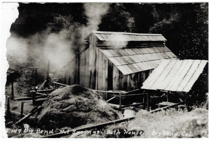
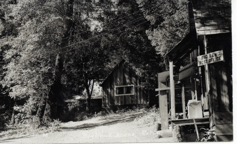
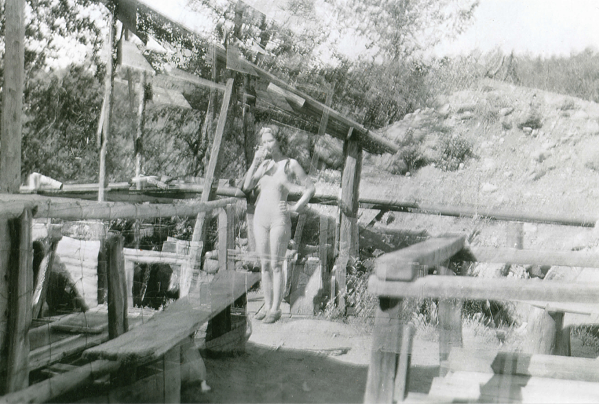
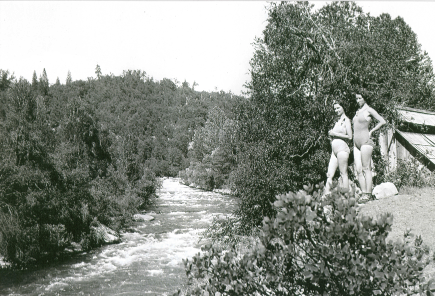
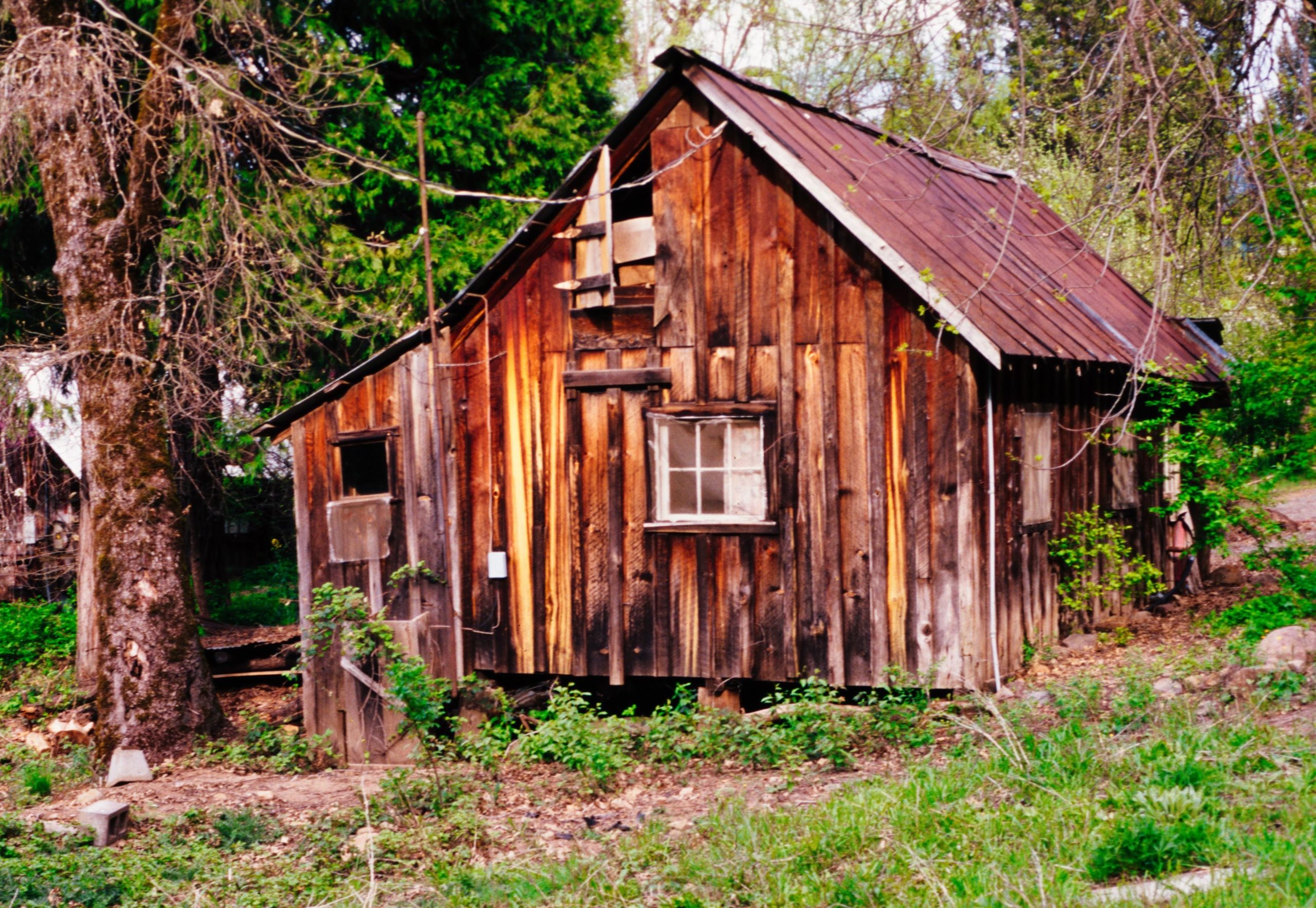
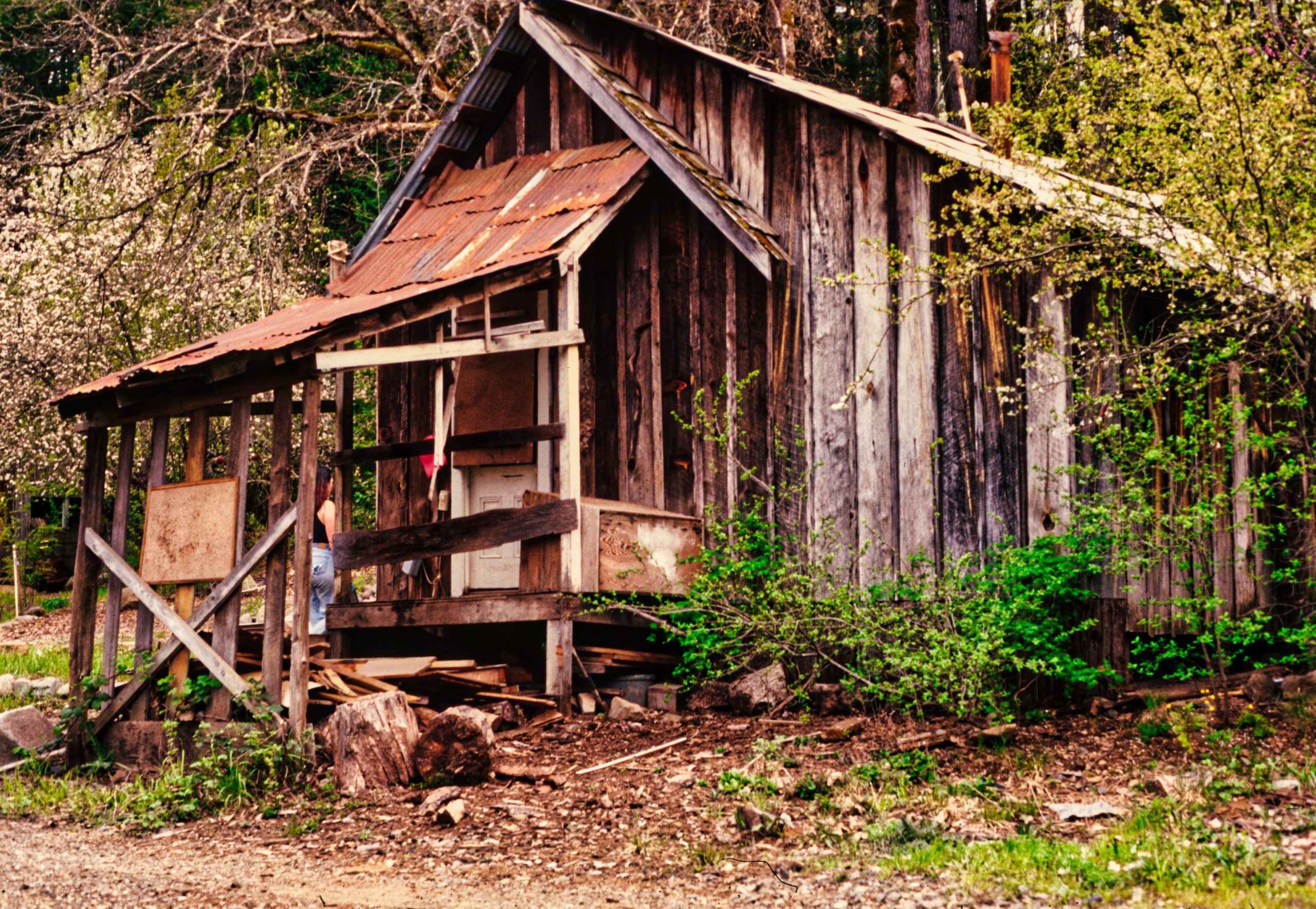
Two views of BHHS Bath House (just below Lah-lah-Pismah Mother Source Hot Spring) , likely from the 1920s or 1930s:

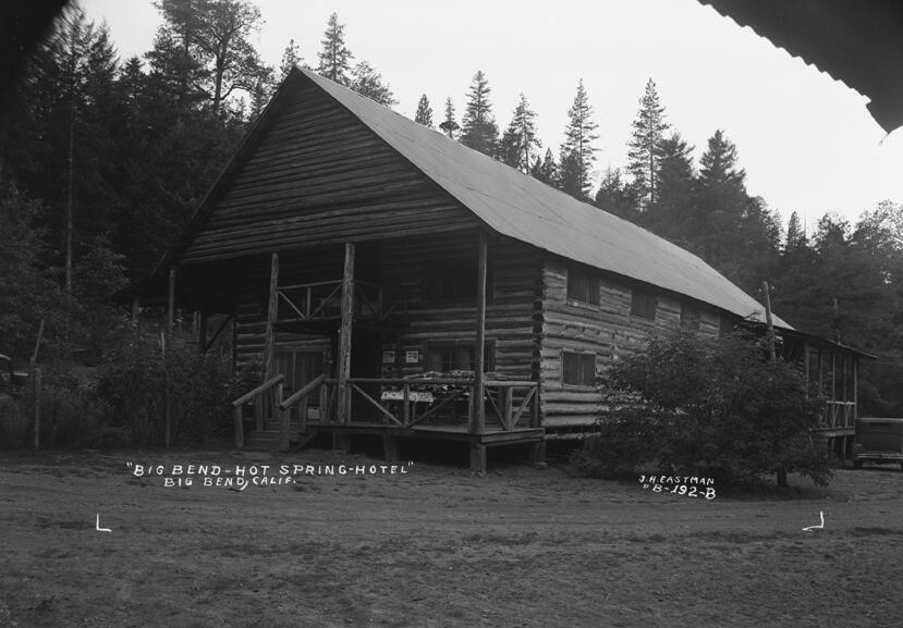
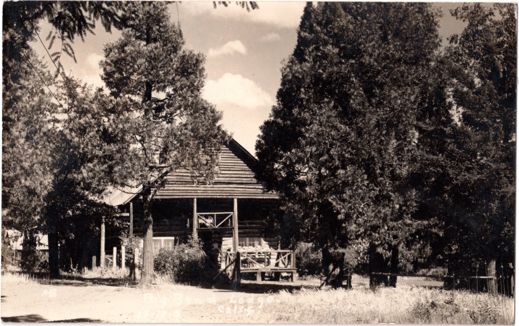
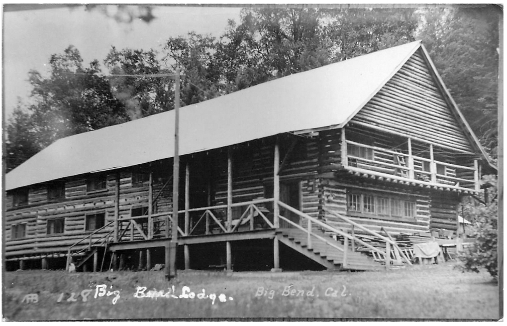
1926 – A turn-of-the-century hotel at the site burned in 1926 and was later replaced (1930) by a two-story lodge that also burned.
1927 – From Shasta County records: “Lodge built out of logs with gabled metal roof.”
1940s – Big Bend became a hydroelectric dam construction Boom Town, reportedly with around 9,000 valley residents, such as lumberjacks, dam engineers, dam builders, hard-rock miner tunnel diggers, service industry professionals, families of dam workers, etc.
1942-1944 Pit 5 Diversion Dam, Tunnel Reservoir, and the Pit 5 Powerhouse built by electric utility company, which later became P.G.&E.
194?-1949 – Lovina Hull held the deed to the Big Bend Hot Springs Property, which included 200 acres on both sides of the Pit River
1949 -1973 – Martha E. Lofton held the deed to the Big Bend Hot Springs Property, which included about 200 acres on both sides of the Pit River (24 years)
1958 – Shasta County Assesor’s Notes: “This property was a business venture with the hot mineral springs as the attraction. It consisted of a Lodge building- 28 years – with 12 sleeping rooms and 3 cabins and a house. The buildings are old, of poor construction, and in need of repair. The Big Bend Post Office is located in the Lodge building. Apparently customers for the baths are few and far between. The land is brush and small timber of little value.” Interests: Martha Ellen Lofton, Sophronia Nan Gronwoldt, Allen Brown, and Meryl Riddle
Memories from Randy Compton: “I remember this building when I was a kid. Clarence Lofton lived there and he would let us go down to the river and around. Once he walked down and saw us naked in the bottom pool on the gravel bar and got really pissed off. This was also a hunting club for doves or pigeons and there was a place by the trail where they used to clean the birds they shot and it was a thick carpet like 12 inches or so thick of old, decomposed feathers. I always used to wonder how many birds it took to make such a carpet.”
~~~~~~~~~~~~~~~~~~~~~~~~~~~~~~~~~~~~~~~~~~~~~~
1950’s and 1960s – The Lofton Family owned the Hot Springs property, and ran the hotel, cabin rentals, saloon, etc.
1960’s until 1973 or 74 – The Lofton Family closed the business and eventually rented the property to a Hunting Club, primarily to hunt the Band-Tailed Pigeons that flock to the special mineral site all spring, summer, and fall, to eat the salt crystals from the hot springs known as the “Queen’s Bath” on the river bank. The hunters only occasionally came to the land, leaving the Big Bend locals to have the run of the place.
1973 -1977 – County records indicates six buildings on property.
1974 – Mary Ellen Lofton (Martha’s Daughter) sold the property to William and Elizabeth Dickinson (3 years)
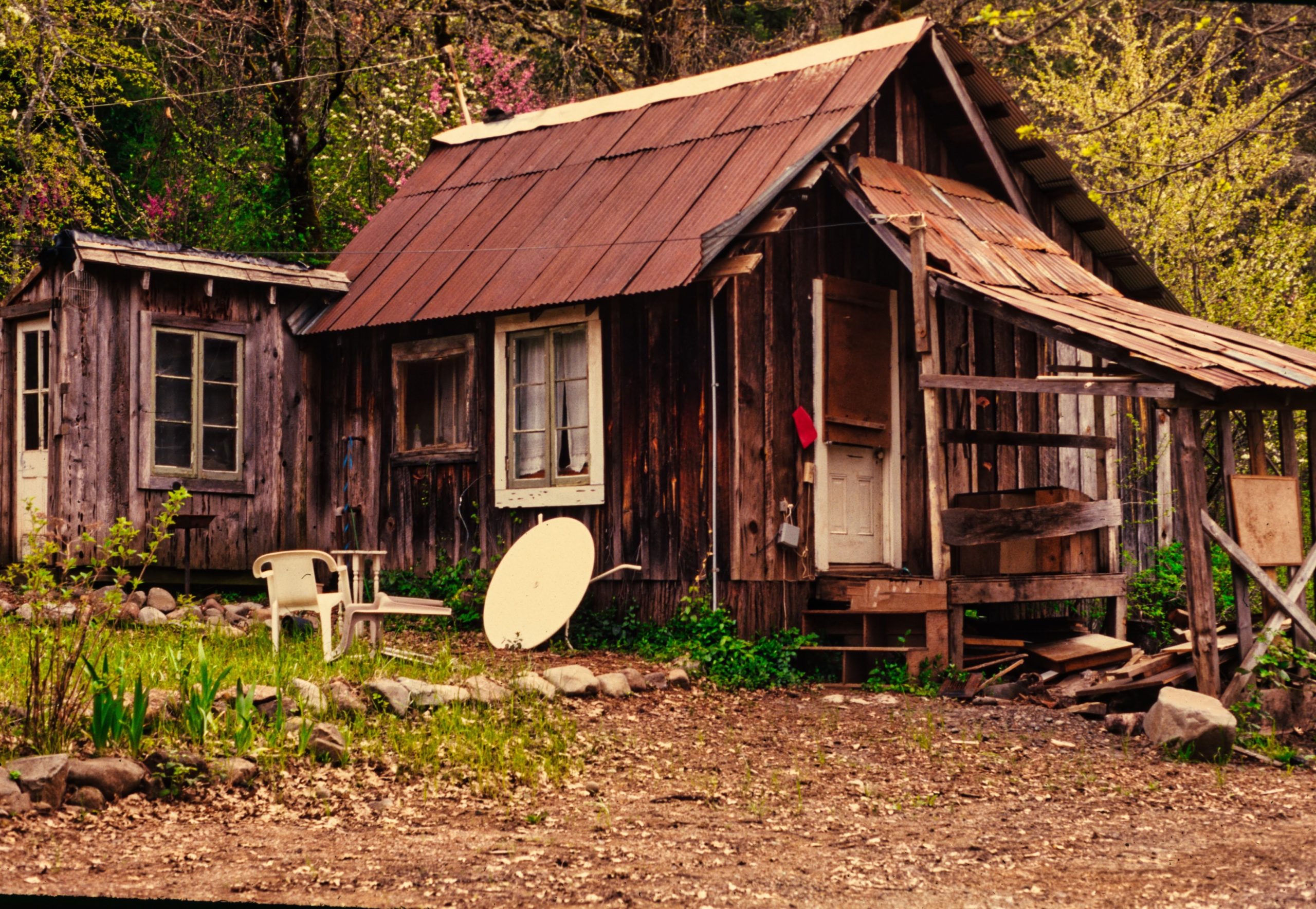
1975 -1977 William and Elizabeth Dickinson owned and managed the property for about three years. Their daughter, Deanna, reported the following: “I am William and Elizabeth Dickinson’s daughter. My husband, David McCall, our twin daughters and I lived in the old lodge from the time my folks bought the place until it was sold to the Hendershots. We lived there in the old Lodge for 9 months in 1976/77, we were young with twin toddlers. Otherwise, we used the place on weekends, etc.
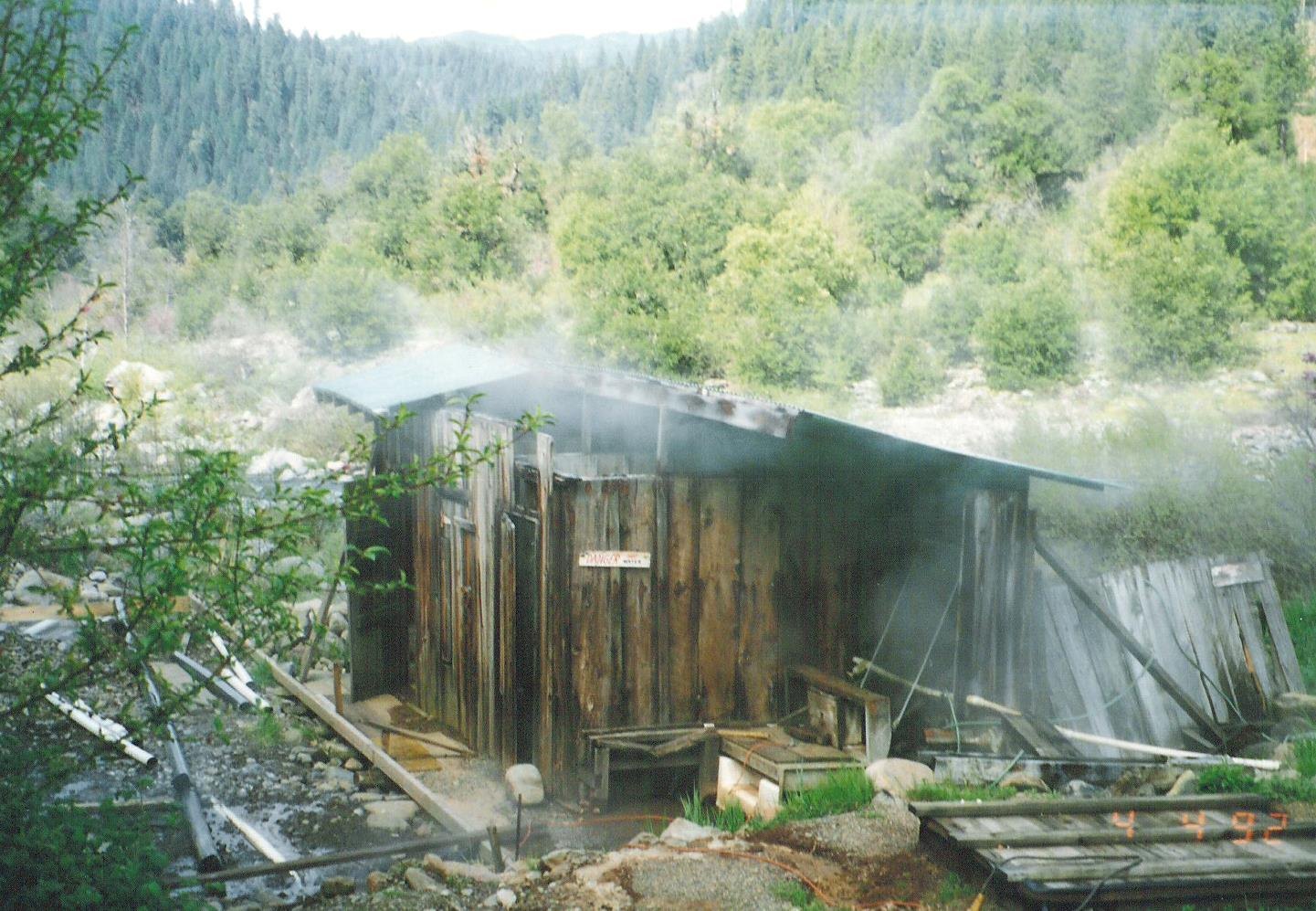
We had to test the temp of the hot water every day, it fluctuated greatly. The water was piped into each tub and room and ran into open troughs. You placed cold water in the tub first, then added hot to your preference. You controlled the temp by adding how much hot water you wanted by placing a little board in the trough to stop the flow, much like a miniature irrigation system. Water for the buildings came from a spring a small distance away.
My husband worked construction in the Redding area… He, his brother, and his father built new bath houses. The previous ones had collapsed and were unsafe. The tubs were brought up from Redding. (The bath houses used) water from both the hot water and cold water from what was called Squaw Creek, the small stream flowing down to the river. Folks came to bathe and to fill water bottles to take home. Many older people would drive for hours to come get the water to drink.
We collected day use, overnight camping, fishing, and bathing fees. A couple rented space for a tepee back further in the woods, I want to say their last name was Gillispie. Bert Holmes and his wife lived the closest.
That group, the Essenes, is who caused the fire and for the building to be a total loss. The logs used to construct it were phenomenal, unbelievable in length and girth, running the length of the building. So much history was lost, the cleats from the logging boots (that the loggers) had worn, the stairs that lead to the rooms (there were no outside stairs). The old “commercial” kitchen and dining room were also left intact, as was everything in the Lodge.
Heritage gardens and orchards were between the buildings and the river, with many varieties of fruit and berries no longer seen. While cleaning the place up we uncovered a huge amount of vintage beer cans, they were under the wood stove ash piles. Some were quite rare. Hendershot wanted them, so we sold them to him.
. (-Memories from Deanna Dickinson)
1977 – Art and Jan Hendershodt buy the property from the Dickinsons (September) (18 years +).
1977 -1995 – Camp Preventorium and The Essenes (under Art and Alice Hendershodt)
1978 – Jerry Kakuk and Family arrive, set up lumber milling operation on lower riverside area.
Some of the Main Members of The Essenes:
1. Arthur “Art” Hendershot (1977 to 1994 RIP),
2. Alice Hendershot,
3. Jan Hendershot (son of Alice & Art, with his two sons & two daughters),
4. Cathal “Cal” McCarthy (1988 to 1996),
5. Janice McCarthy,
6. Tony Cardenas,
7. Sharon Cardenas
8. Dan Christiansen (with three sons: Dorian, Duncan, and Danien)
9. Tom Lundy
10. Jerry Kakuk (and family, including three daughters)
11. Laurence Ostrow
Some of the Stories of Big Bend Hot Springs During the Essenes Commune Period (1977-1996):
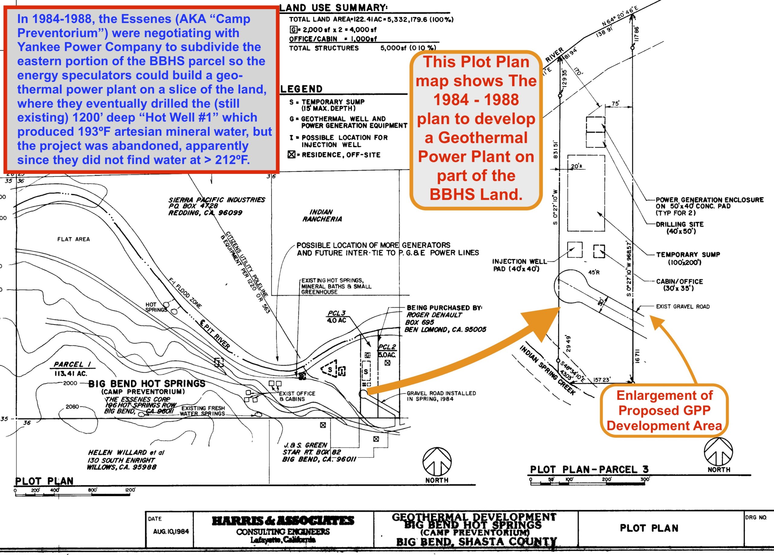
1984-1988 – A small power company called “Yankee Power” made a deal with the Essenes to drill several deep geothermal test wells to explore the possibility of finding steam (geothermal water above 212ºF) with the goal of building a geothermal power plant on the eastern part of the property. The plan was abandoned, apparently because the water in their test wells was not hot enough and they had numerous organizational and permitting obstacles.
1980s-1990s – Most of the available information that we have found about the Essene’s 18+ years of trying to live a communal life in paradise at BBHS is from the final years, so we can assume that many amazing times during the 1980s were enjoyed by the group, which had numerous changes in memberships over the years. Families lived there together, children were born and raised there, and gardens and orchards were developed, etc. The communal life surely had many ups and downs for the Hendershot’s experimental Essene group. By the early 1990s, some heated battles were waged between various members and factions of the Essenes, most notably battles for control of the property… A long and drawn-out pattern of feuds and struggles, occasionally resulted in one group/faction prevailing, followed by another sub-division of alliances, and then a new battle for ownership and/or control…
Art and Alice Hendershot lived in Riverside (southern California) and owned a health food store near Los Angeles, where they were also producing and selling Chlorella as a health supplement. They wanted to purchase a hot spring (with another friend) to start a community and utilize the therapeutic benefits of soaking in hot mineral waters. They found Big Bend Hot Springs in their search, sold their health food store in Riverside, and bought the property in 1977, forming the Essene Community.

When the Hendershots arrived, the old hotel was still standing (by the upper gate) but it eventually burned down (some locals blamed the Essenes for the fire) and was never replaced. Alice was said to be a well-loved school teacher (and then principal) back in the Midwest before moving to California, and when the old school where she served most of her career was being torn down in the 1970s, the officials sent her the old school bell, which still hangs in a double trunked Black Oak tree (now known as “The Bell Tree”) near where the “Clock Cabin” used to stand, on the level above the hot springs. The Essenes used to ring the bell to alert community members of meetings and meals. They had a communal kitchen in a small building near the garden by the bell, where members would gather and share food, etc.
Jerry Kakuk (along with his whole extended family) was one notable character who had a huge impact on progress at the Hot Springs in the eighties and nineties. When the Kakuk clan arrived at BBHS in 1978, the maintenance and development of the property took on a whole new level, since Jerry has an incredible range of skills and equipment, such as construction, large equipment operations and repairs, excavation, lumber milling, welding, and much more. The Kakuks lived in the Clock Cabin during the colder months, and, for several summers in a row, the Kakuk clan moved a trailer, a tipi, and Jerry’s Saw Mill down to the grassy flat slightly down river from Oolaymoomay Hot Springs (formerly known as “Indian Hot Springs”). Jerry not only raised several kids with his wife Bonnie (daughters Quiana, Korey, & Jamie), but he also put in huge amounts of time, energy, and skilled work to make many changes and improvements at BBHS.
Today, some of Jerry’s welding projects are still enjoyed at BBHS: Both of the main gates, and the old foot bridge (replaced in 2017) over Indian Springs Creek. All three of these superbly functional welded pieces continued to work well for decades, with only minor maintenance needs- AND, the gates swing both ways, which is handy and classy. Jerry also built plenty of other things, and did significant grading and other backhoe work at BBHS, and milled a lot of lumber.
Jerry had an incredible amount of energy and was always a very humble, friendly, and generous person. He helped countless community members with countless projects from large to small. Jerry was celebrated (and is remembered) as a community elder, as he continued to do what he had apparently always done: operate, maintain, and repair large machinery, serve his local community as a sweet mild-mannered mentor, enjoyed his large extended family, helped people fix things, etc. Jerry also served as one of the first Board Members of the Big Bend Community Land Trust (a non-profit 501(c)(3). Gratitude for all you did and all those that you helped, Jerry, rest in peace.
Dan Christiansen had an incredible “green thumb,” and was the main gardener in that era, transforming the BBHS grounds into a lush food forest, while raising his twin sons, living near the Confluence hot spring. Dan created numerous gardens and planted most of the perennials now currently enjoyed (over 40 fruit trees and grape vines are now being nurtured by BBHSP, and shared within the BB community). Thanks, Dan- You (and the legendary mulberries…) are remembered and appreciated by many.
Art and Alice Hendershot’s son, Jan, and his four children also moved onto the property (1987-1991?), and Jan eventually took over his parents’ shares of ownership after his mother, Alice, died (1991?) and his father, Art, died in 1994. Jan was a pacifist (and a conscientious objector during the Viet Nam War), and when the Essenes began feuding over control of the property (he was even apparently assaulted once in an argument), he eventually left, and sold his shares to Tony and Sharon Cardenas.
The Dominion of Machizideck Drama:
1994 – David Korem (a.k.a. Branch Vinedresser), recently released from prison for fraud charges, and his wife, Pearlasia (started Bank of Asia) and their friend, Takiba moved to Big Bend Hot Springs, and their story reads like a comic book filled with bizarre fraudster villains. They were apparently total convicted financial scammers, and for a short time, they tried to run their scams from BBHS, and eventually were facing more financial fraud charges from Shasta County and California District Attorney prosecutors. Branch and Pearlasia (both had numerous pseudonyms) also got involved in the ongoing dispute of trying to gain ownership and control over the BBHS Essenes property.
There was apparently a three-way battle for property ownership between Tony, Art, and David/Branch… David tried to transfer property ownership to the “Dominion of Melchizedeck,” Korem’s fascinating “micronation” scam, which combines religious, diplomatic, financial and international fraud into one gloriously mad scheme, after another. The serious fraudsters were like bizarre comic book characters. A small example of their shenanigans is shown in this short interview clip of Pearlasia, in which (just after the 4:30 minute mark), she refers to the BBHS cabin (known as the “Cedar Cabin”) near the bank of the Pit River (torn down in 2009 as part of compliance with Shasta County building inspectors’ requirements). The small geothermally-heated cabin was where Pearlasia and David Korem AKA “Branch Vinedresser” lived and ran their scams from for a short time. (Here is the link to short interview that mentions the cabin at BBHS: https://youtu.be/aEPRWqZS52A).

See 60 Minutes News story (2000)“Fantasy Island: A Convicted Man Creates a Country” here: https://www.cbsnews.com/news/fantasy-island/
(Old link is apparently no longer available):
http://www.cbsnews.com/stories/2000/04/10/60II/main182244.shtml
Some parts of the long and bizarre story:
Mark Logan Pedley (born 1953-07-19 in Los Angeles, California) (also known as “Tzemach Ben David Netzer Korem” and “Branch Vinedresser”, etc.) is the son of convicted scam-artist, David Evan Pedley. Mark apparently worked with his father David to commit some fraudulent scams, and both were eventually convicted and jailed. He had his parole revoked by his parole officer in late 1991 due to a violation of his conditions. Pedley was released from his parole in July 1994. The Pedleys were also the co-author of the Melchizedek Bible, most of which Mark wrote while in prison. After his release, in 1994, Pedley married Pearlasia Gamboa, a Philippina woman who shared a common interest of furthering the cause/fraud of Dominion of Malchizedeck. Mark (AKA David Korem) also served as the Head of the House of Elders, the Vice President of the Executive Branch, and the Chief Justice of the Supreme Court of Dominion of Malchizedeck until 2006.

From the Former Dominion of Malchizedeck official website www.melchizedek.com:
Frequently asked questions (FAQ) about the Dominion of Melchizedek
(No actual questions were on the old FAQ section, just the following B.S. and Lies…)
The Dominion of Melchizedek is an Ecclesiastical Sovereign Nation State, which lays claim to an ancient tradition dating back to the Biblical Salem (modern Jerusalem) over which Melchizedek was the sovereign. The people of Melchizedek desired independence so their leaders signed a formal Constitution on 7 July 1991, thereby forming a government of the people based upon ecclesiastical and democratic principles.
On 26th November 1994, the Dominion of Melchizedek acquired (or claimed) full ownership and sovereignty over the Karitane Islands in the South Pacific and on the 5th of May 1999 acquired sovereign rights over the Taongi Islands in the North Pacific from the island’s Iroijlaplap. In the year 2000, Rotuma, which is north of Fiji, signed a constitution, wherein Melchizedek was granted all of the same rights and privileges enjoyed by the Vatican in Rome, and Melchizedek acquired sovereign rights over Solkope, one of the 7 islands surrounding Rotuma. The formerly unclaimed 90-150 degrees West Antarctica was claimed by Melchizedek in 1990, and said claim was published in The City Paper in Washington DC in 1991.
Former Address (apparently a rented mail box location) Dominion of Melchizedek Embassy-at-Large: 585 Box Canyon Road, Canoga Park, Ca., 91304 (U.S.A.) Tel: 1-818-703-6236
Trouble for Branch, Pearlasia and the Doomed DoM:
(From news reports)- Based more on tax laws than territory, Melchizedek may have been be the ultimate post-modern state. It appeared to exist mainly so that money could be whisked through fake shell banks… Its founder, a Californian named (by his parents) Mark Logan Pedley, has two swindling convictions. Its president, a woman who goes by the names Mz. Pearlasia and Elvira G. Gamboa (her birth name), was successfully sued by the California State Banking Department to prevent her from representing herself as a banker there… “It’s a con artists’ operation through and through,” declared John Shockey, head of the fraud unit in the office of the U.S. Comptroller of the Currency. “It’s a phony bank, a phony country, a phony dominion — the whole thing’s a phony.”
In fact the Dominion of Melchizedek was/is the invention of David Korem aka Ambassador Korem aka Branch Vinedresser aka Mark Pedley who is a preacher turned conman who was imprisoned for financial fraud in the early 1990’s. After a January 1991 Forbes Magazine report on the Dominion of Malchizedeck and associated banking fraud schemes, Pedley landed in prison in California for parole violations. He had been a codefendant with his father, David, in an alleged Mexican peso conversion swindle. Pedley Sr. had a record of four convictions, including stock fraud…
Reporter Interviewed Korem: Finally, we meet. Ambassador Korem (DOB July 19, 1953) is a striking figure, dressed in a loose tunic and sporting a biblical-style cap. His beard flows to mid-chest, after the custom of “the Nazarites,” he explains. Korem introduces his wife, Pearlasia, a Filipino resplendent in a red silk blouse and hand-woven skirt laced with thick golden threads.
The ambassador holds forth in a conference room seemingly made available to all the tenants of this particular floor, including those who, like Korem, only rent mailbox space. Korem has taped the flag of Melchizidek on one wall. He explains that he is shopping for a permanent location on Massachusetts Avenue’s classy embassy row… The delegation also presents a copy of the Melchizedek Bible, price $24, which is the Word as “metaphorically translated” by David and Mark Pedley, who received their instructions from God while in prison.
Court Ruling: Defendant ELVIRA GRACE GAMBOA a.k.a. PEARLASIA is the alleged President of THE DOMINION OF MELCHIZEDEK (DOM), and Defendant MARK LOGAN PEDLEY a.k.a MARK WELLINGTON a.k.a. BRANCH VINEDRESSER a.k.a. DR. TZEMACH “BEN” DAVID NETZER KOREM PHD. is the alleged Vice-President of THE DOMINION OF MELCHIZEDEK (DOM). Defendants have ‘engaged-in’ and ‘continue to commit’ ‘securities fraud’ and/or ‘market manipulation’…
Update: In 2010, Mark Pedley was jailed in Florida for a penny-stock fraud, involving issuing and selling a large amount of stock based on worthless mining claims. He was said to be released from a Florida prison in June of 2021. Elvira Gamboa continued the Melchizedek operation and was being investigated since 1995 but apparently managed to avoid prosecution. When the State of California pursued an indictment against her, Gamboa declared “spiritual war” on the State. She and Pedley apparently divorced, and in 2011, the SF Weekly ran a cover story feature about “PearlAsia” in which she mentions living in the now demolished cabin at BBHS: https://www.sfweekly.com/news/fantasy-island-the-strange-tale-of-alleged-fraudster-pearlasia-gamboa/
————————————————————————–
1994 – Essenes declare bankruptcy and Art Hendershot dies in car accident.
1994 (March)- In a Shasta County Court Case, the Judge decided Art and Jan are removed as Directors, and appointed Cal McCarthy and Lawrence Ostrow as new Directors.
1994 – Art Hendershot dies in a mysterious car accident (locals speculated that his brakes might have been maliciously damaged).
1994-1996 – Property ownership question, battles, and litigation continues (Rod Johnson arrives on the scene)
1995 – Cal McCarthy applies for mobile home permit under name “Healing Waters Camp” (other Essene members officially protest to Shasta County)
1995 (April) – Members of the Essene Corporation attempt to divide land and transfer ownership of 131 acres to the “Dominion of Melchizedeck” (including Takiba B. Davis Jr. ??)
1995 – The Essenes name is changed to “Healing Waters Corporation” by Tony Cardenas, manager.
1996 – Ownership question in litigation (?) and electricity cut off due to hazardous conditions
1996 – Healing Waters under Tony and Sharon Cardenas (hired Duane Light, lawyer, prevailed in court, won ownership of property).
1997 – 2006 – Healing Waters under Fifth Sun LLC & Danny Gonzales (sold to Danny by his cousin, Tony) with Rod Johnson as caretaker and manager (9 years)
1999 – Shasta County passes new zoning ordinance with conditional use permit, making the eastern 20 acres of BBHS a newly zoned Comercial-Recreational (C-R) district, subject to long list of conditions needed for legal commercial operation..
2007 – Healing Waters closed by Shasta County for code and permit violations, Rod moves out.
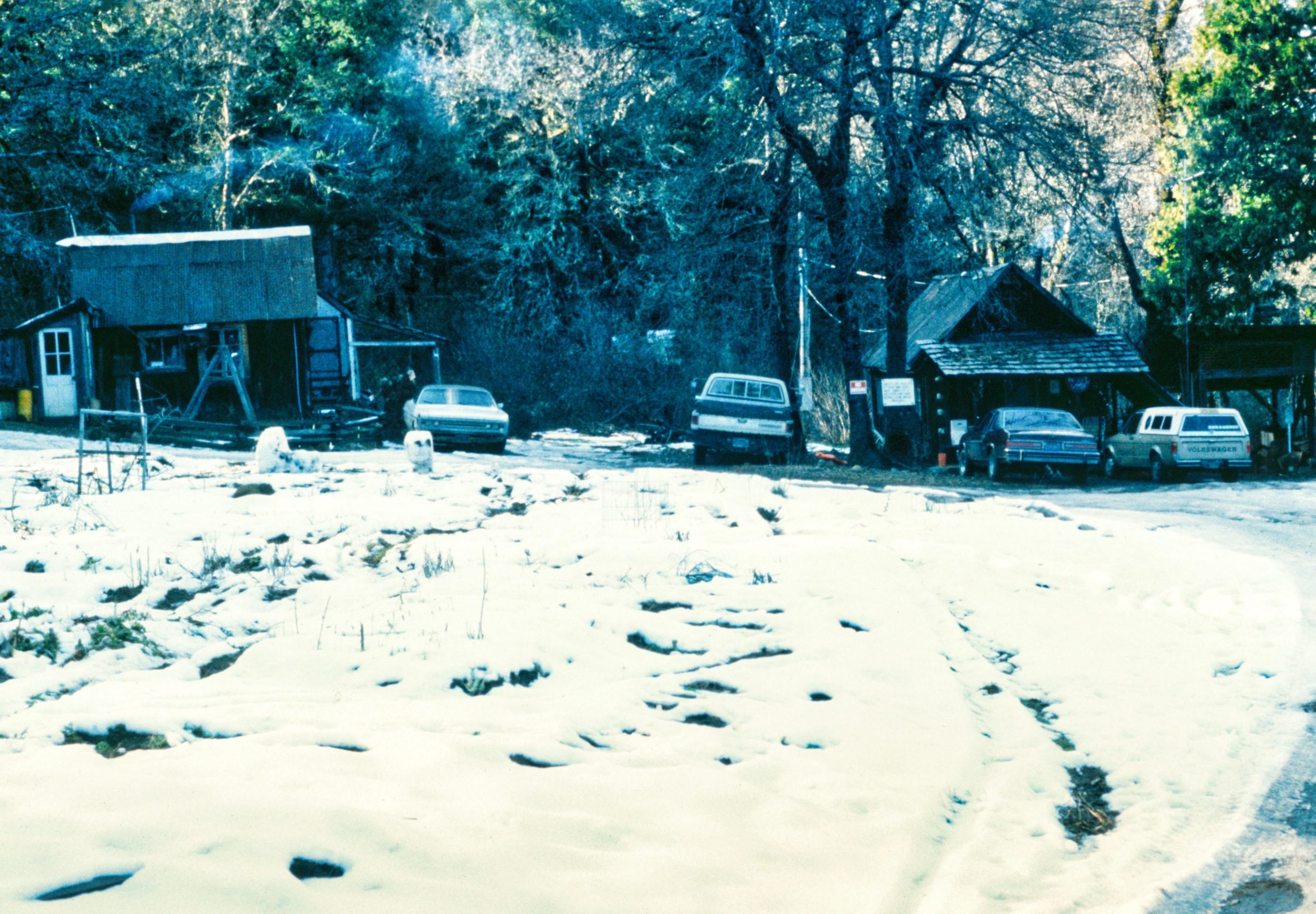
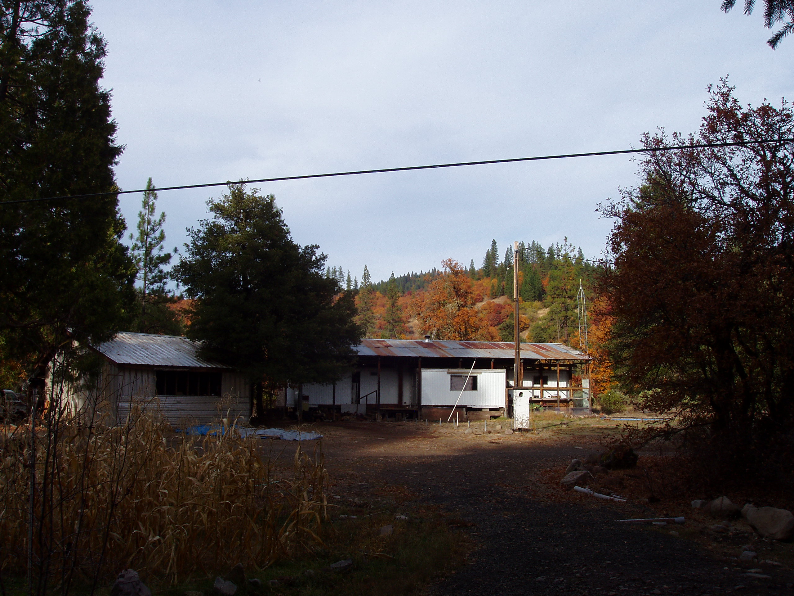
Pictures of old trailer complex (removed in 2006 or 2007), where new campground central plaza is planned:

2008 to Present – Big Bend Hot Springs Project group of land stewards arrives with goals to protect and re-open the hot springs and campgrounds (sold to BBHSP by Danny Gonzales). Please see the rest of this web site for more recent history and information about the goals of BBHSP.
And, if you have read the whole history on this page- CONGRATULATIONS, and thank you for your interest and time!! That’s impressive. Additions, corrections, suggestions, etc. can be sent to: history “at” big bend hot springs (with no spaces) “dot” org
One more recently published description: “The Hot Springs and Big Bend area is bathed in a rich and colorful history… Today, the Big Bend Hot Springs enjoys a reputation as being one of the best Hot Springs in the West with its high water quality and temperature and having the added fortune of being surrounded by incredible mountain scenery.” And of course (in addition to the “rich and colorful” history), we would add that it’s very important that we remember and acknowledge the tragic horrific and brutal genocidal part of the history as well, as we work towards healing and reconciliation now and in the future. Thanks for your participation.
———————————————————–