Ancient Volcanic Mega Magma Mountain Range: The Cascade Range, or “The Cascades”, is a major mountain range of western North America. This massive stretch of high elevation alpine peaks (and all the valleys, rivers, glaciers, cliffs, creeks, forests, habitats, organisms, and spectacular volcanoes) is a global treasure with so much wild beauty, wildlife, incredible ecosystems and vistas. **This article is about the Cascade Range, where BBHSP is located, but the real focus of this post is on the volcanic geology and the resulting geothermal activity that we love so much.
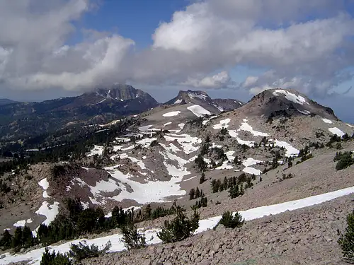
BBHSP is located in Madesi territory, near the southern tip of the Cascades. Lassen Peak, which is right here in Shasta County (in northern California) is the south end of the enormous mountain range, which goes over 700 miles to its north tip, passing through California, Oregon, Washington, and British Columbia (ending near the Fraser River region in BC). The range is especially appreciated for its active volcanic arc, jagged glaciated peaks, and dense evergreen forests. The North Cascades are widely considered the most beautiful section, while Mount Rainier is rated the most dangerous. Volcanoes and eruptions happen throughout the Cascades, with many peaks reaching over 10,000 feet (over 3,000 meters)!
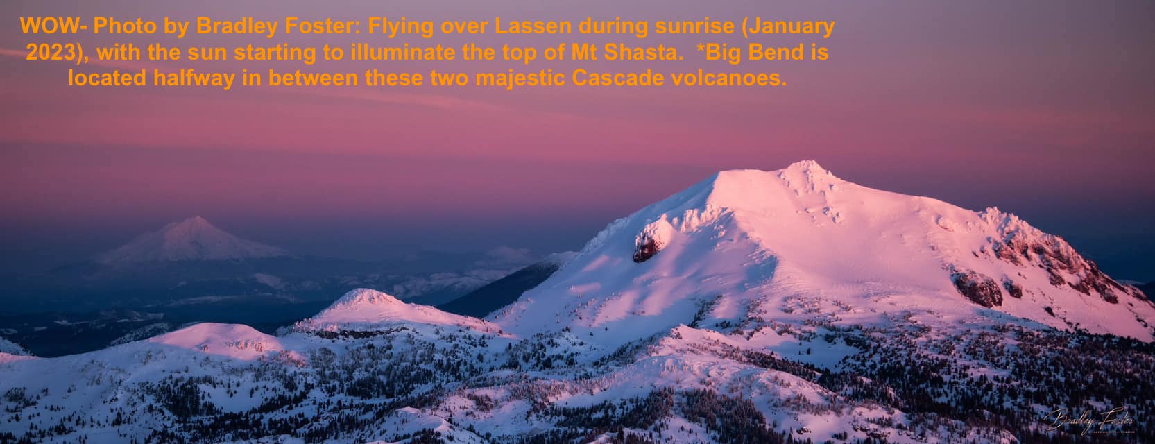
These gorgeous and impressive geologic wonders (including the volcanic and geothermal aspects) were created (and are still being formed) by the collision of two tectonic plates. This is the result of Earth’s crust and upper mantle layers sitting on top of the very hot and molten layers beneath the upper mantle. These moving parts and plates have been shifting and colliding and rising and sinking for over four billion years, and they still continuing to morph and inspire awe every day. This inspirational geo-drama results in earthquakes, ground shifting, tsunamis, and most excitingly, volcanoes (with their associated magma, lava, and geothermal features)! These processes are endless, potent, sometimes unpredictable, and geologically profound. There will likely be another Cascade Range volcanic eruption coming soon!
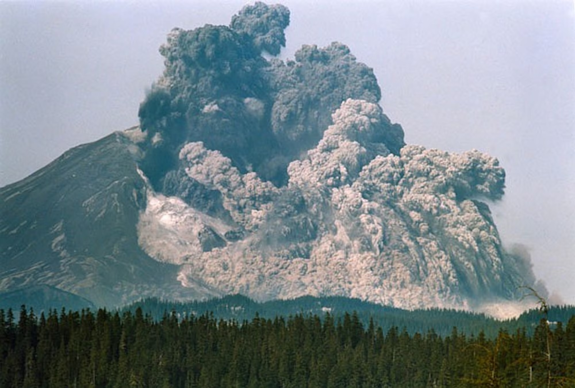
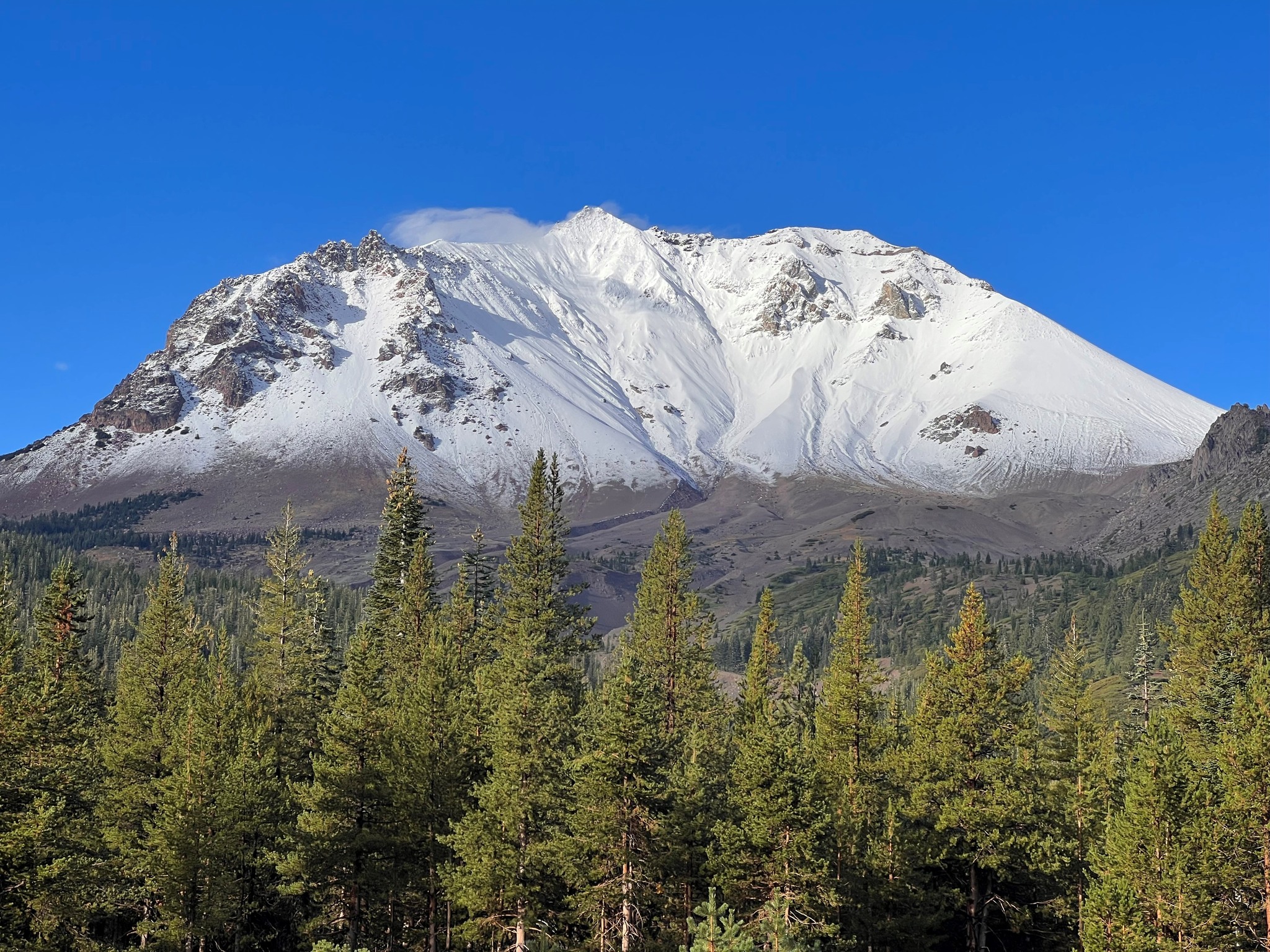
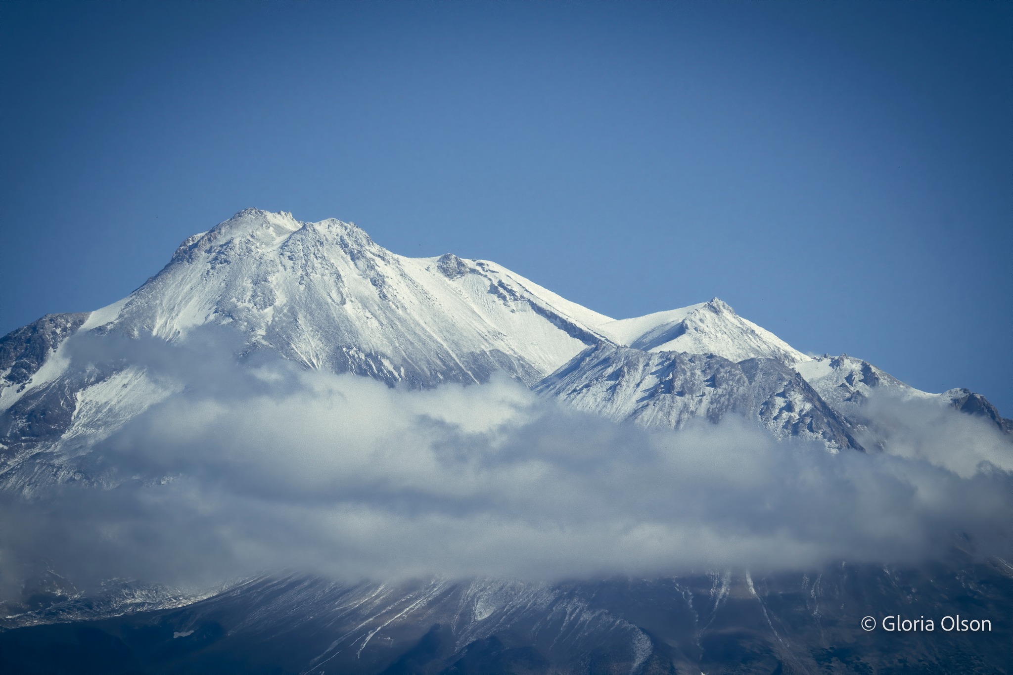
Cascade Range Splendor: There are 4,375 named mountain summits in the north-south running Cascade Range, mostly considered “extinct” volcanoes. But all major volcanoes in the Cascade Range are geologically active. Even if they are considered to be extinct, some of these beauties are historic volcanic giants, such as Mount Rainier, Mount Hood, and Mount Shasta. At the summit of Mt. Shasta, there is even a small opening that releases hot steam and volcanic gasses (that’s called a fumarole, which could be thought of as a tiny hot spring, or a steam spring).
Sometimes There is Too Much Pressure: Lassen Peak, near Big Bend, is a massive lava dome reaching an elevation of 10,153 feet. The mighty and beautiful volcano is 60 miles SE of Mount Shasta, and is the southernmost volcano in the Cascade Range. This is where the hard Basalt bedrock base of the Cascades finally gives way to the more Granite-based geology of the Sierra Nevada Mountains. Several other Cascade Range volcanoes have erupted in the recent past, but Lassen Peak’s famous multiple eruptions of 1914-1917 were reportedly quite dramatic.
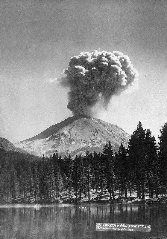
During one massive Lassen eruption in 1915, Shasta County’s most powerful volcano belched out a large explosion resulting in Lassen shattering its own lava dome, creating a new ominous crater at the summit. Then, glowing super heated blocks and blobs of hot lava from the dome explosion fell on and around the summit and other deeply snow-covered upper flanks of Lassen Peak, which happened to have more than 30 feet of snowpack that year!
As the snow melted, it caused a slushy avalanche of volcanic sediment sludge down the steep slopes in huge volumes. This well-lubricated collapsing voluptuous volcano transformed into a giant moving molten mudflow materials mix and was not messing around. This chain reaction dangerous volcanic menace is called a lahar, (which is a fast-moving, destructive volcanic mudflow or debris flow). As the flows slowed, both the avalanche and lahar released huge volumes of muddy water, flooding all the way down Hat Creek more than 30 miles to the Pit River Ahjoomah, where many fish were killed from all the sediment in the water.
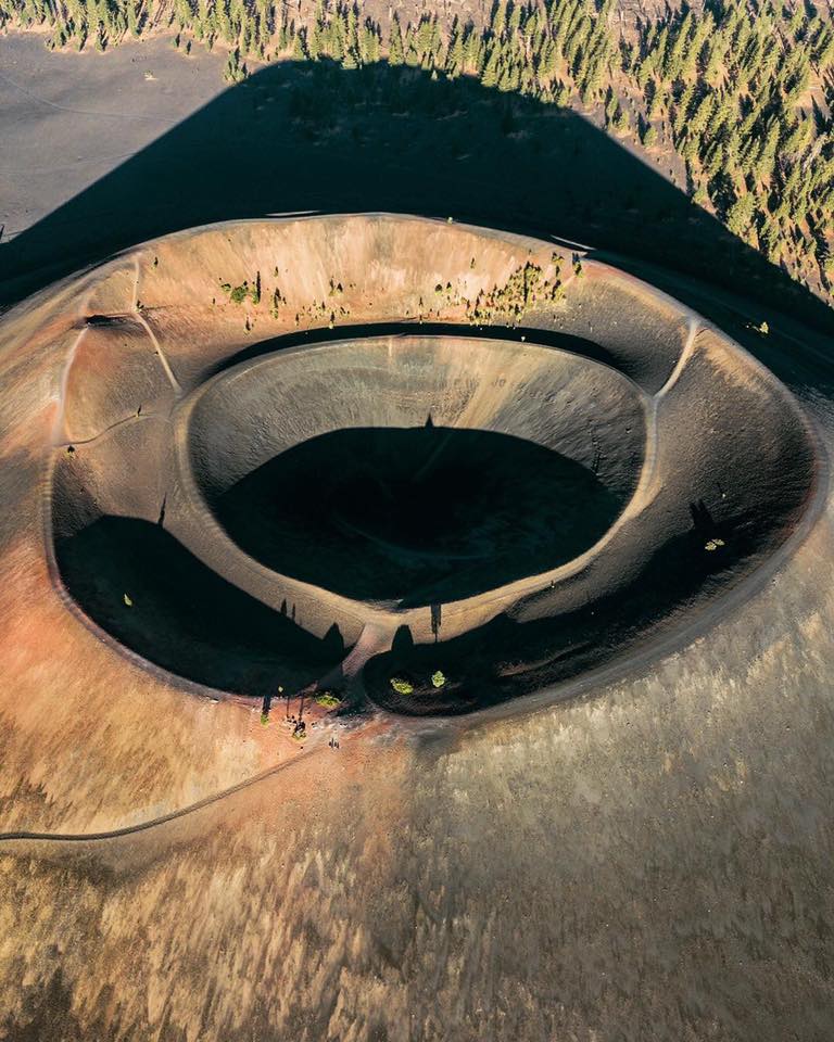
Lassen Peak is not far from Big Bend (only 30 miles to fly, if you were a Raven). This majestic mountain marks the southern terminus of the Cascade Volcanic Arc. Lassen Peak is located in Shasta County, and is the tallest point in the County, standing at an elevation of 10,457 feet (3,187 meters). It is not a difficult climb, with a short trail hike to the summit from the top parking lot in Lassen Volcanic National Park
(link: https://www.nps.gov/lavo/index.htm)
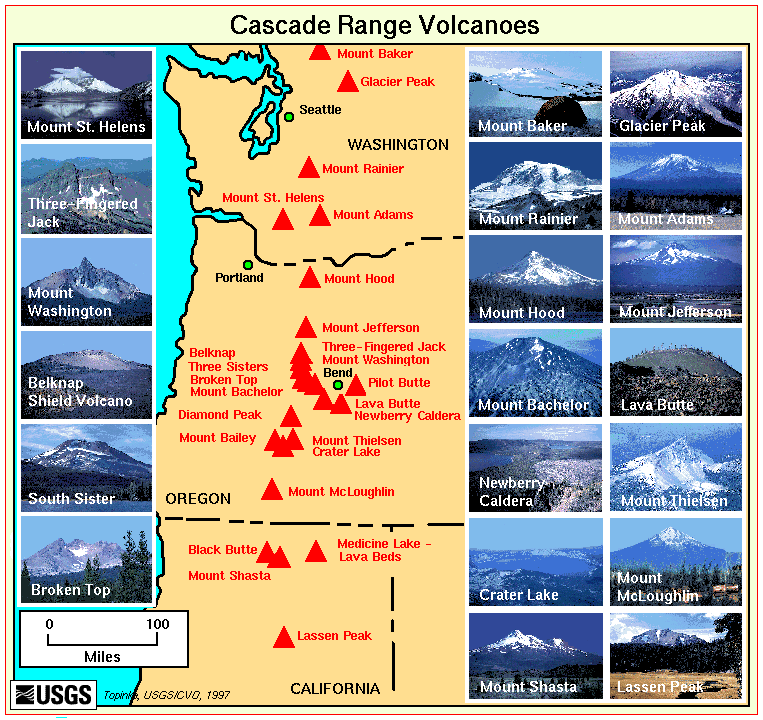
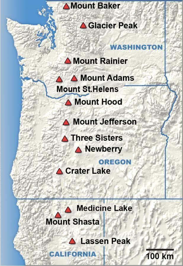
You Never Know: It’s likely that one or more of the Cascade Range volcanoes will erupt before too long. The USGS keeps updating their potentially active volcanoes list, which includes Mount St. Helens, Mount Rainier, Mount Hood, Mount Shasta, Glacier Peak, Mount Baker, Newberry Volcano, Three Sisters, Crater Lake (Mount Mazama), and Lassen Peak among the high or very high threat systems. What could possibly go boom?
It’s The Water: Visiting the Cascades can illustrate plenty of fascinating stories of millions of years of change, some abrupt, and even current activity today. Given the geothermal and explosive factors, these mountains are dynamic and sometimes unpredictable. Mountains in the Pacific Northwest generally have historically wonderful water wealth, with precipitation, snowmelt, springs, and lakes, but volcanic mountains have highly porous rocks and soils that tend to soak up winter and spring precipitation like a sponge, and then release it gradually. Thanks to those amazing volcanic water storage facilities, the Cascades are known for year round fresh water springs throughout the range.
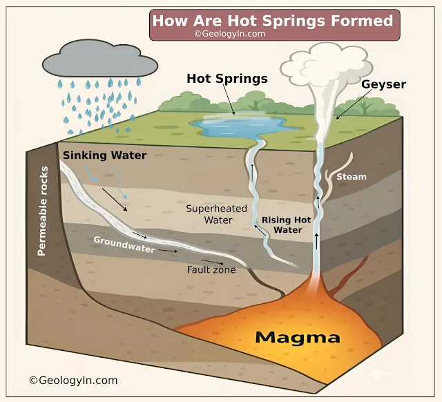
Another special feature of the volcanic geology happens when some of that precious water absorbs and seeps down deep enough to come into contact with the super heated rocks way down near the ancient magma levels and the lava tubes that we imagine are like the Lemurian plumbing systems of the chain of volcanoes. This can be called, “Cascade Mountains Volcanic Geothermal Dynamics”. What a blessing!
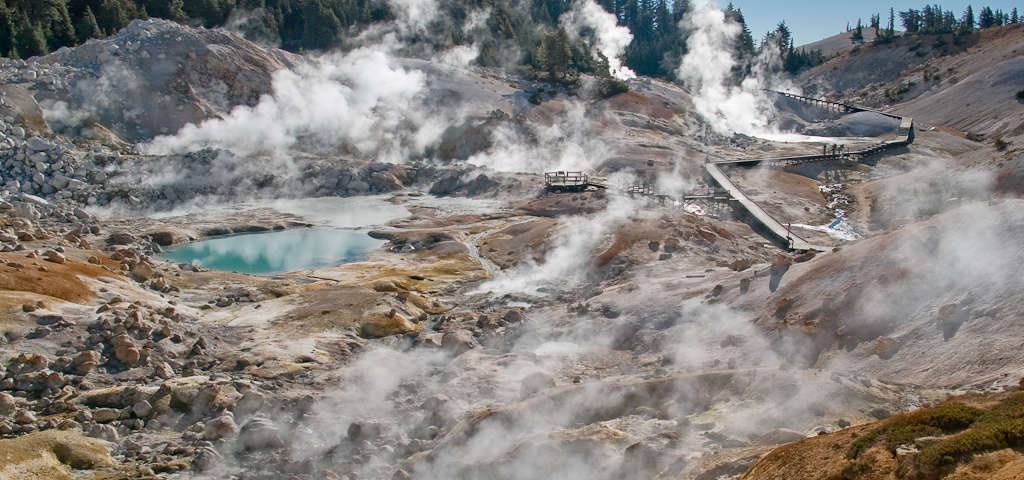
The iconic mountain range with so many volcanoes exists because of the tectonics of plate subduction, as the Juan de Fuca Plate is actively diving beneath the North American Plate offshore of the Pacific Northwest. That causes a lot of friction, which creates immense amounts of heat. There are hot springs all over the Cascades, and the most well known volcano for geothermal activity is the Lassen Volcanic National Park:
But How Does That Work?!? The Cascade Mountain Range has geothermal activity in many areas along its range, because it sits above that active subduction zone, generating underground magma heat. That plate tectonic motion creates unimaginable amounts of friction, caused by the immense pressure combined with the immense masses moving in opposite directions while rubbing against each other.
You Crack Me Up: We Are So Hot!
As the plates build up pressure, they eventually slide or move, sometimes in huge sudden jolts. Each resulting earthquake can be considered an Earth Orgasm. Friction causes heat and fault lines and cracks in the bedrock, where water can move around in the rocks and minerals over millennia. Many hot and warm water spots and sometimes even steam bubble up as hot springs throughout the Cascades because of these dynamics. In Lassen National Park some of the hot springs have surface temperatures that can reach higher than boiling (water boils at around 212ºF or 100ºC)!!
*A fault, or a fault line, is a giant underground crack in the bedrock and soil, which are part of the Earth’s Crust. No one knows for sure, but some think the major geologic fault line under Big Bend is about 8-10 miles long. It could be part of other big fault lines known to be just south of the Big Bend area… Minor fault lines sometimes intersect with the Major fault and that’s often where surface hot springs come up.
More Geologists & Research Needed!
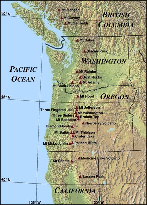
The Cascades are part of the Pacific Ocean “Ring of Fire”, which is a huge ring of volcanoes and associated mountains around the Pacific Ocean. All of the eruptions in the contiguous USA over the last 200 years have been from the Cascade volcanoes. The two most recent eruptions were Lassen Peak from 1914 to 1921 and a major eruption of Mount St. Helens in 1980. Minor eruptions of Mount St. Helens have also occurred since, most recently from 2004 to 2008. The Cascade Range is a part of the American Cordillera, a nearly continuous chain of mountain ranges (cordillera) that form the western “backbone” of North, Central, and South America.
Beautiful, Hot, and Powerful: The Cascades are home to many national parks and protected areas with volcanic history, including North Cascades National Park, Mount Rainier National Park, Crater Lake National Park, and Lassen Volcanic National Park. The northern half of the Pacific Crest Trail follows the range. There are numerous species of extremophile microbes that thrive in the superheated geothermal mineral waters of the Cascades!
Simplified Geology: ***We love input & feedback from actual trained professional geologists. Please send us corrections, as needed.

MAGNIFICENT MAGMA
The Cascade Arc includes 20 major volcanoes along with 4,000 separate volcanic vents. The Cascadia subduction zone occurs along a 680-mile fault line running 50 miles off the western coast. Here, the denser oceanic plate is ‘subducted’ (forced underneath, the continental plate), which heats up the plate and as it descends, water is gradually released from the sediments and minerals, melting the mantle to magically form magma, which then rises toward to earth’s surface to erupt forming a chain of volcanoes i.e. the Cascade Arc above and along the subduction zone. Danger- do not try this at home.
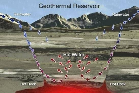
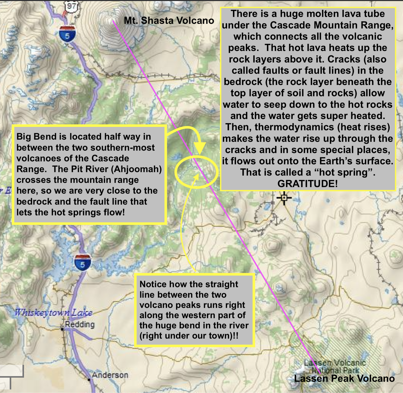
HOT ROCKS: A deep underground magma lava tube apparently extends under most of the Cascade Range, connecting all the volcanoes and heating up the bedrock above, which heats up water that runs into the ground from the abundant rainwater and snowmelt of the Cascades. When the water is heated, it rises and in many cases reaches the surface, which is a hot spring.
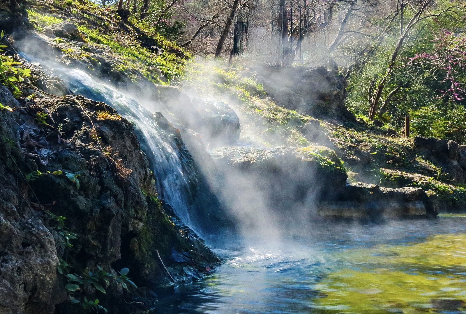
These hot springs are not directly tapping the very deep superheated water nor the magma itself. The water is getting heated less directly, from a shallower, cooler portion of the system (which are super heated rocks that sit on top of the magma). Such water has been heated by the geothermal gradient but most hot springs waters have not traveled deep enough to reach boiling temperatures (212ºF). The hottest superheated water in the Cascades is locked deep below thick dense basalt layers, under high pressure and unable to reach the surface efficiently because of all the rock sitting above it like a geological lid. But thanks to the Major Fault and Minor Faults and cracks in the bedrock, a lot of hot water does reach the surface, which is why there are so many hot springs of various temperatures and flow rates.
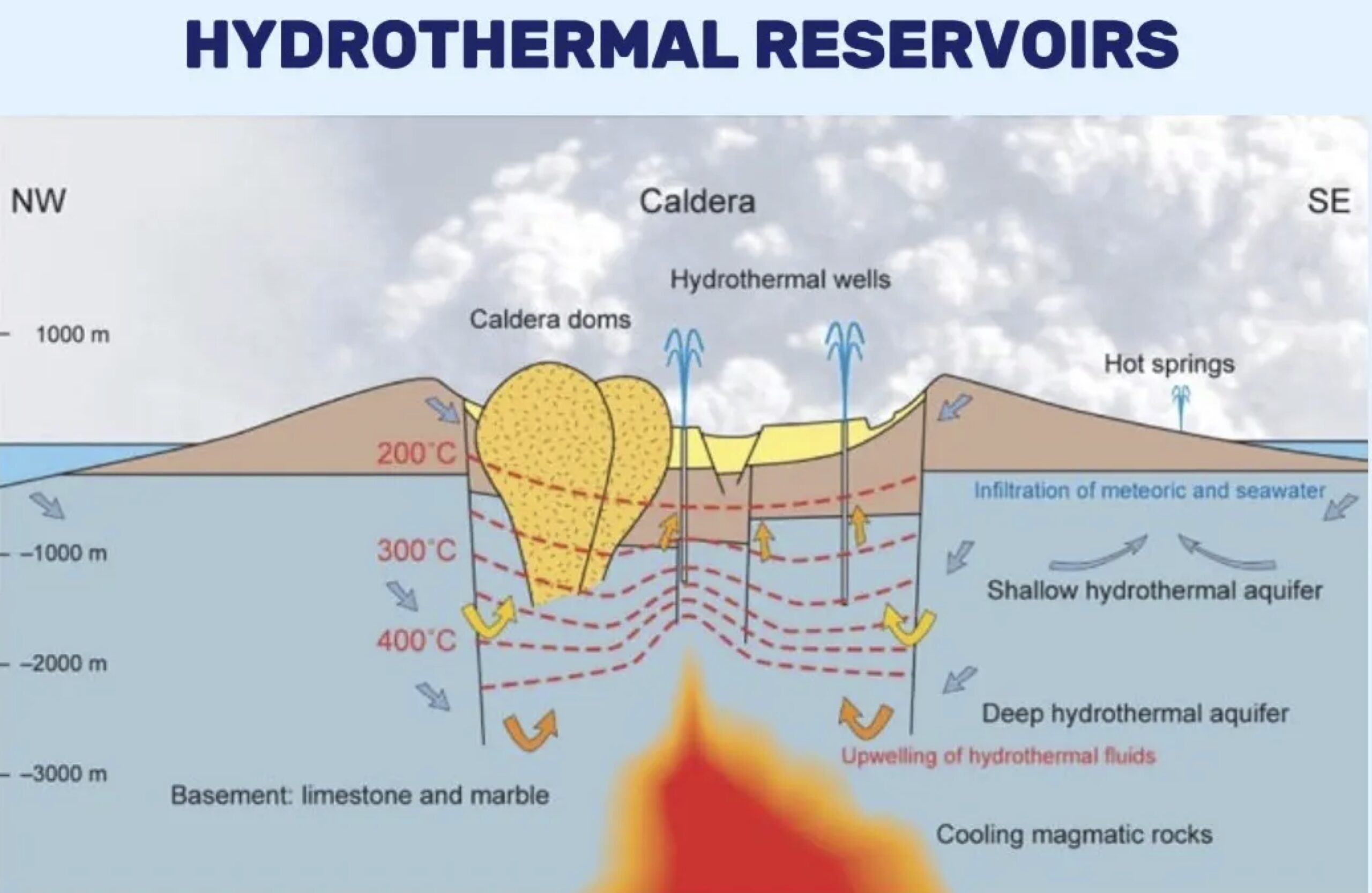
Thermodynamics: The deeper down into the Earth’s crust water can get to, the hotter it gets. The heated water comes up through cracks in the bedrock, where major fault lines connect with minor fault lines, resulting in hot springs, such as the ones in Big Bend (BBHS and Kosk Creek hot springs). Kosk (aka Hunt Hot Springs) is further down the same major fault line that runs under the town of Big Bend & BBHS, and along (under) a section of the Pit River before running under a hill over to the Kosk Creek area, where a few hot springs come up next to the creek.
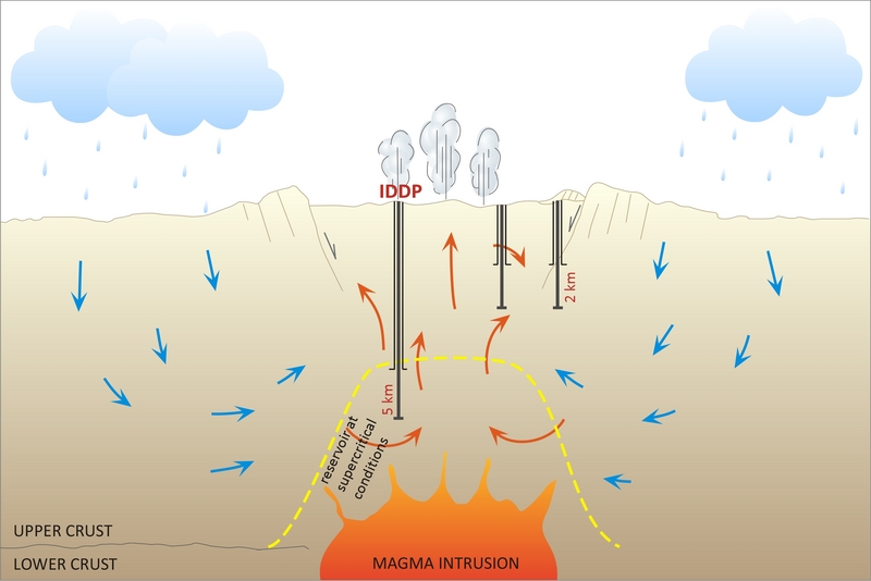
Big Bend, Madesi Valley, Shasta County: Where The Pit River Ahjoomah Crosses The Cascade Mountain Range…
Madesi Territory Geothermal: Right in between Mt. Shasta and Lassen Peak, the Madesi Valley of Big Bend, Shasta County, California, is tucked away in a remote mountain canyon/valley in the southern Cascades. This is where eons of centuries of erosion has carved a path from the mountains and high desert down to the Pacific Ocean. These are the perfect conditions for geothermal waters to come to the surface at numerous points where water flows freely down and up through volcanic soils/rocks, geologic fault lines, and cracks in the shallow (often exposed) bedrock. WOW! *We give thanks and honor the major fault line (and the intersecting minor fault lines) that run right under Big Bend!
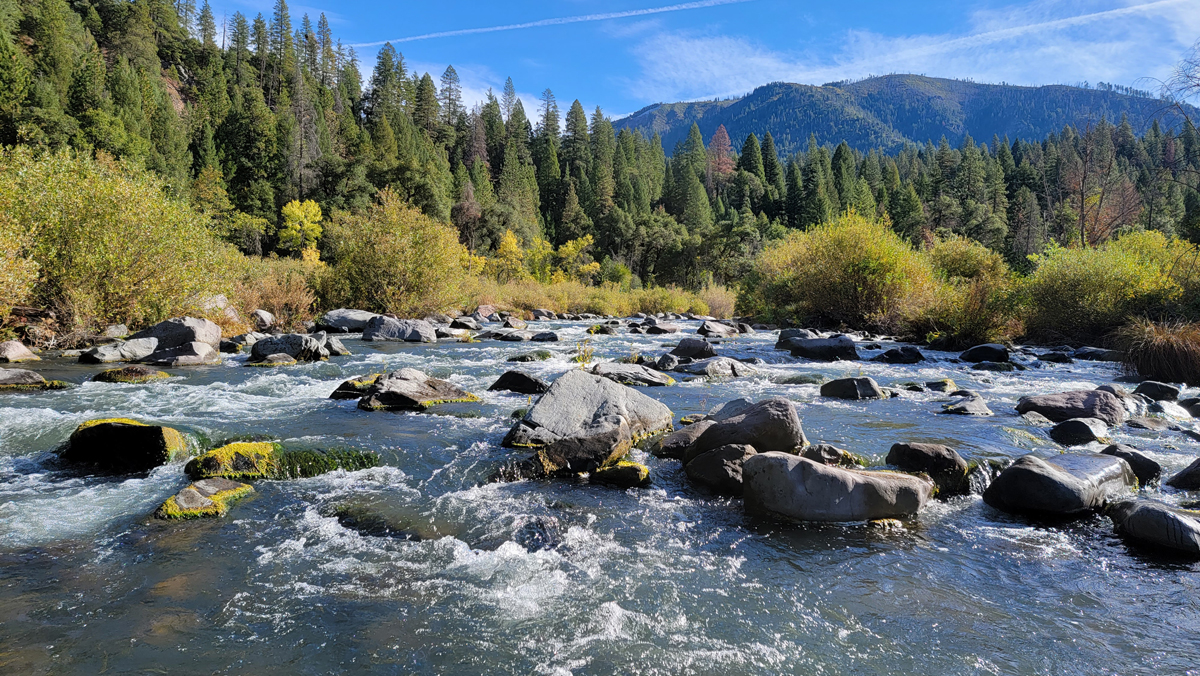
Big Bend Major Geologic Fault Line: Typical of the volcanic Cascade Range, there are numerous geologic fault lines (aka faults) in the region. Here in Big Bend, where the big river crosses the Cascade Range, the local fault (this one is apparently called a “major fault line”) is also present and seems to harmonize with the springs, creeks, land, river, and organisms, as it stretches along under the heart of the town and its main waterways.
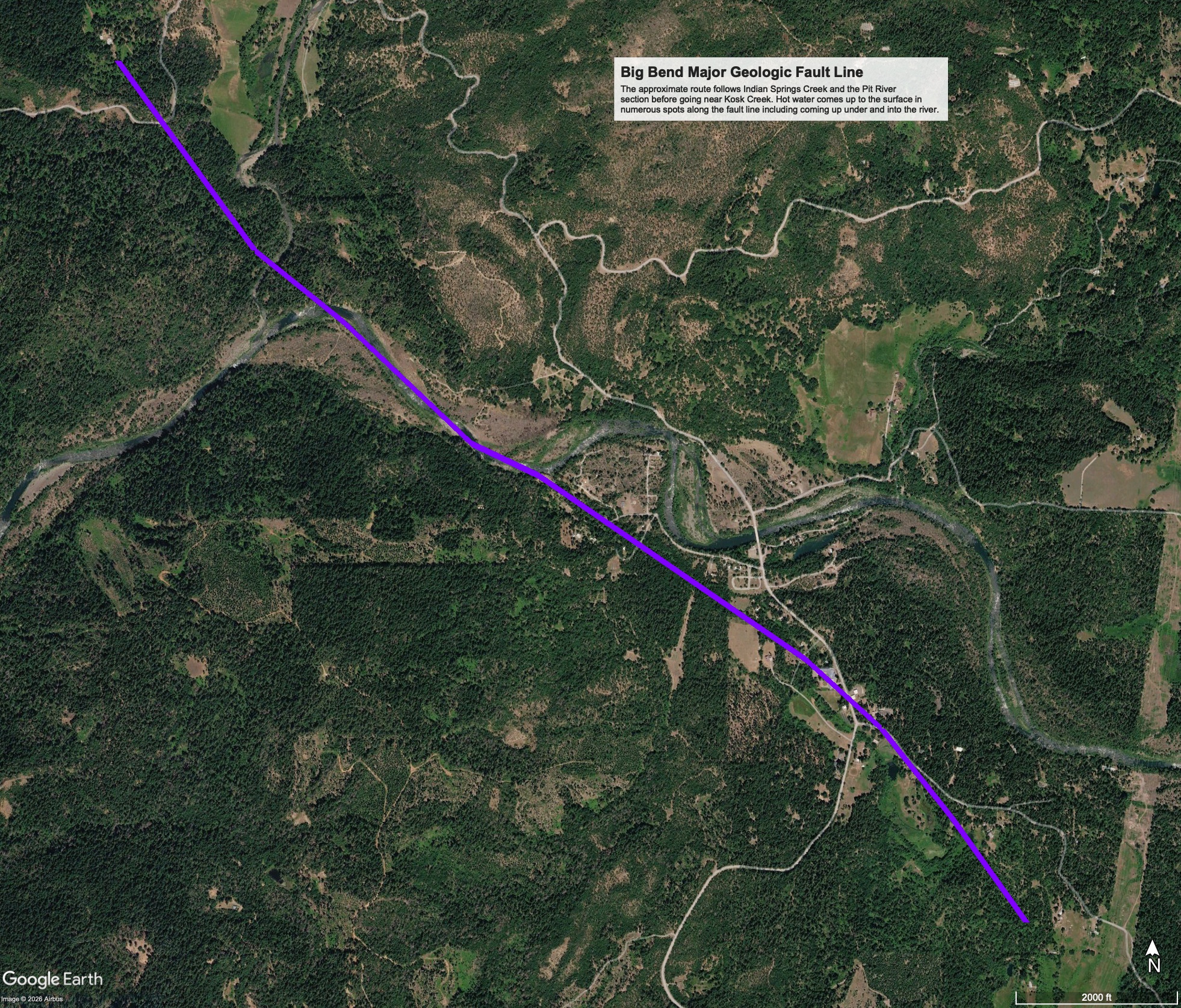
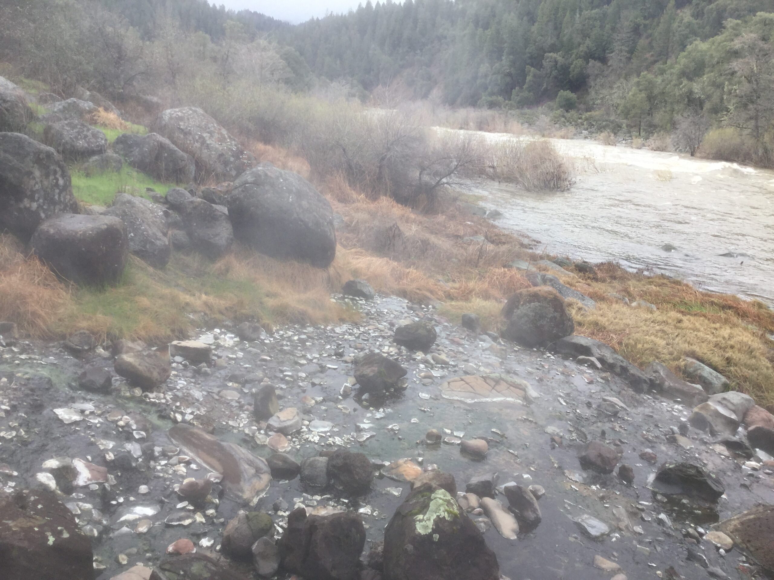
Where is the local Major Fault Line? The approximate known location of the local Big Bend fault (a giant underground crack in the bedrock and soil) is apparently mostly south of Tunnel Reservoir and the PSEA Camp area. It’s more-or-less a slightly wavy straight crack, heading downhill (like the Pit 5 diversion tunnel), towards the river to the west of Hagen Flat Road. It seems to follow a path near Indian Springs Creek, and might be under the creek, as it stays on the Post Office side of Hot Springs Road, the road and across the Big Bend Community Center parking lot, then follows Indian Springs Creek and the Pit River section before going near Kosk Creek. Hot water comes up to the surface in numerous spots along the fault line including coming up under and into the river.
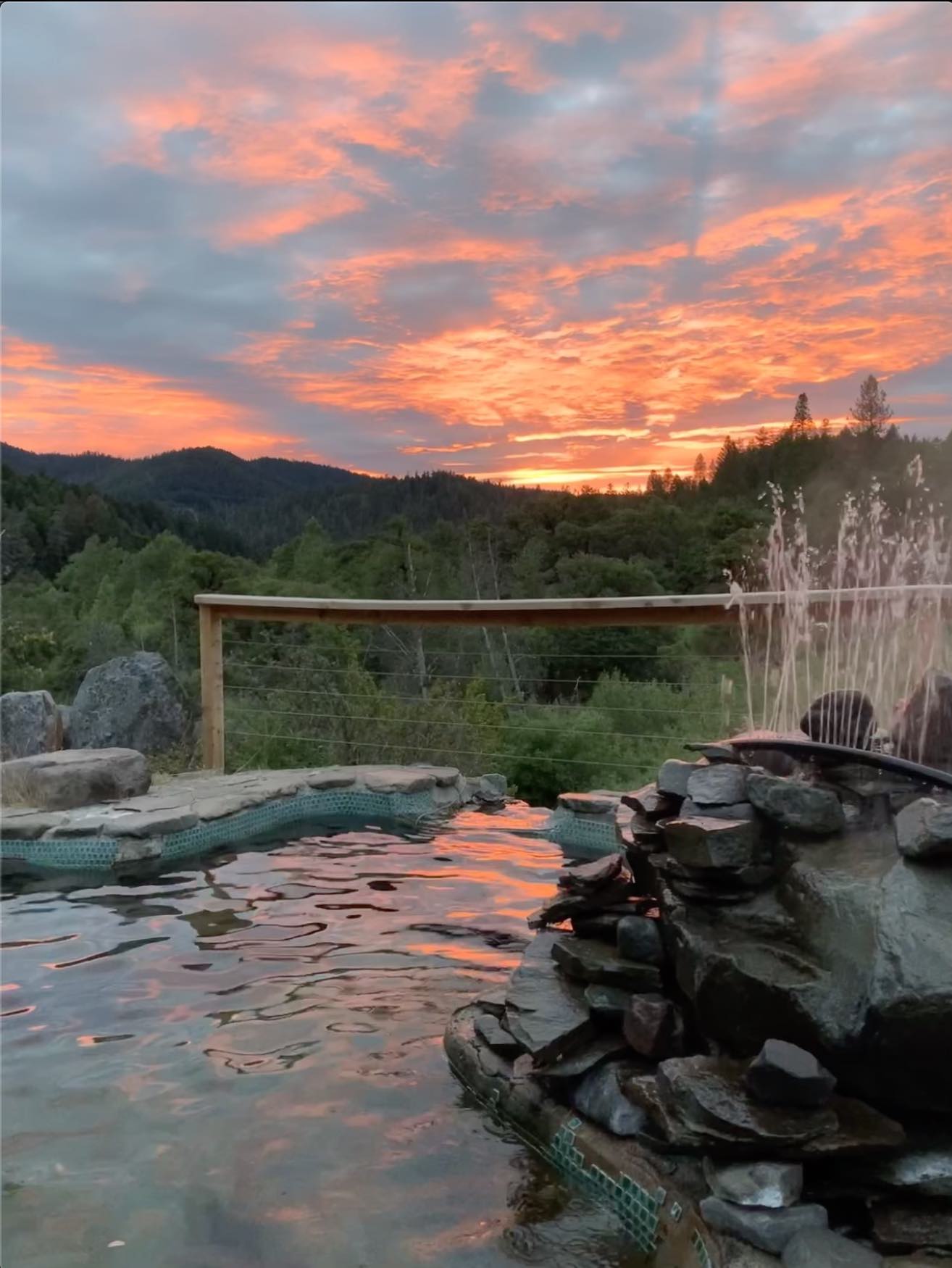
It’s Not Our Fault! Geologic faults are common, especially near shifting tectonic plate edges. Big Bend sits in Madesi Territory, in a remote valley on the eastern side of the Cascade range, halfway in between the two southern-most volcanoes, Lassen Peak and Mt. Shasta. Big Bend is about 30 miles from either summit of these amazing volcanoes, and sits right on top of a major fault line that makes lots of intersecting points with minor fault lines, allowing cold water to seep down and then come back up hot!
Cascadian Geothermal Activity of Big Bend, Madesi Valley:
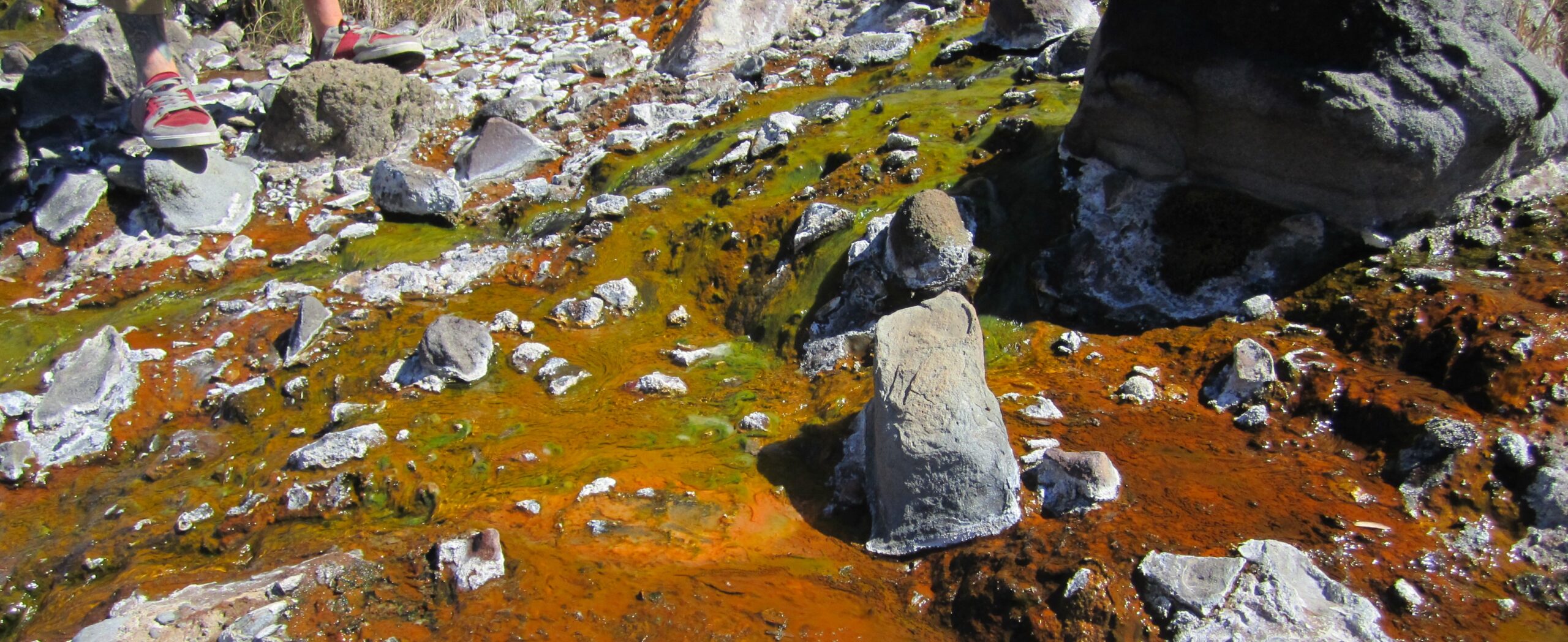
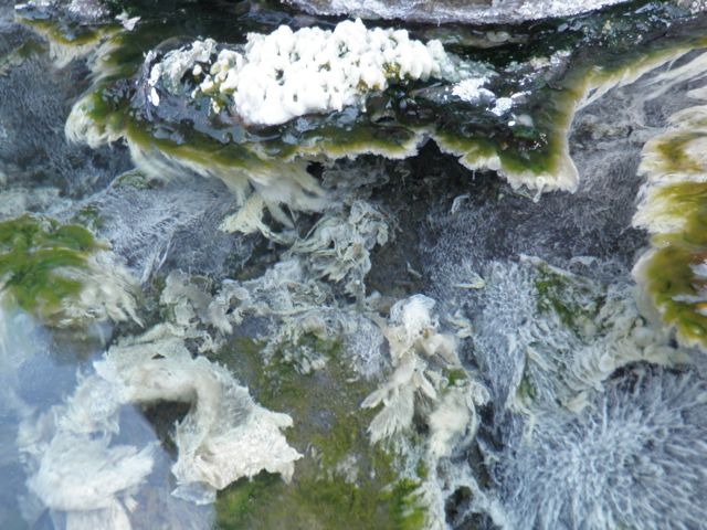
Some geologists have studied the specific local volcanic geoscience of Big Bend to some extent, but it appears that a vast panoply of unique thermal geohydrology and thermophilic biology of this remote and unusual part of the Pit River Ahjoomah, remains undiscovered. Certain hot water algae, zillions of microbes, and bacteria are the only known organisms that can live in such high temperatures. That’s why those kinds of organisms are known as extremophiles.
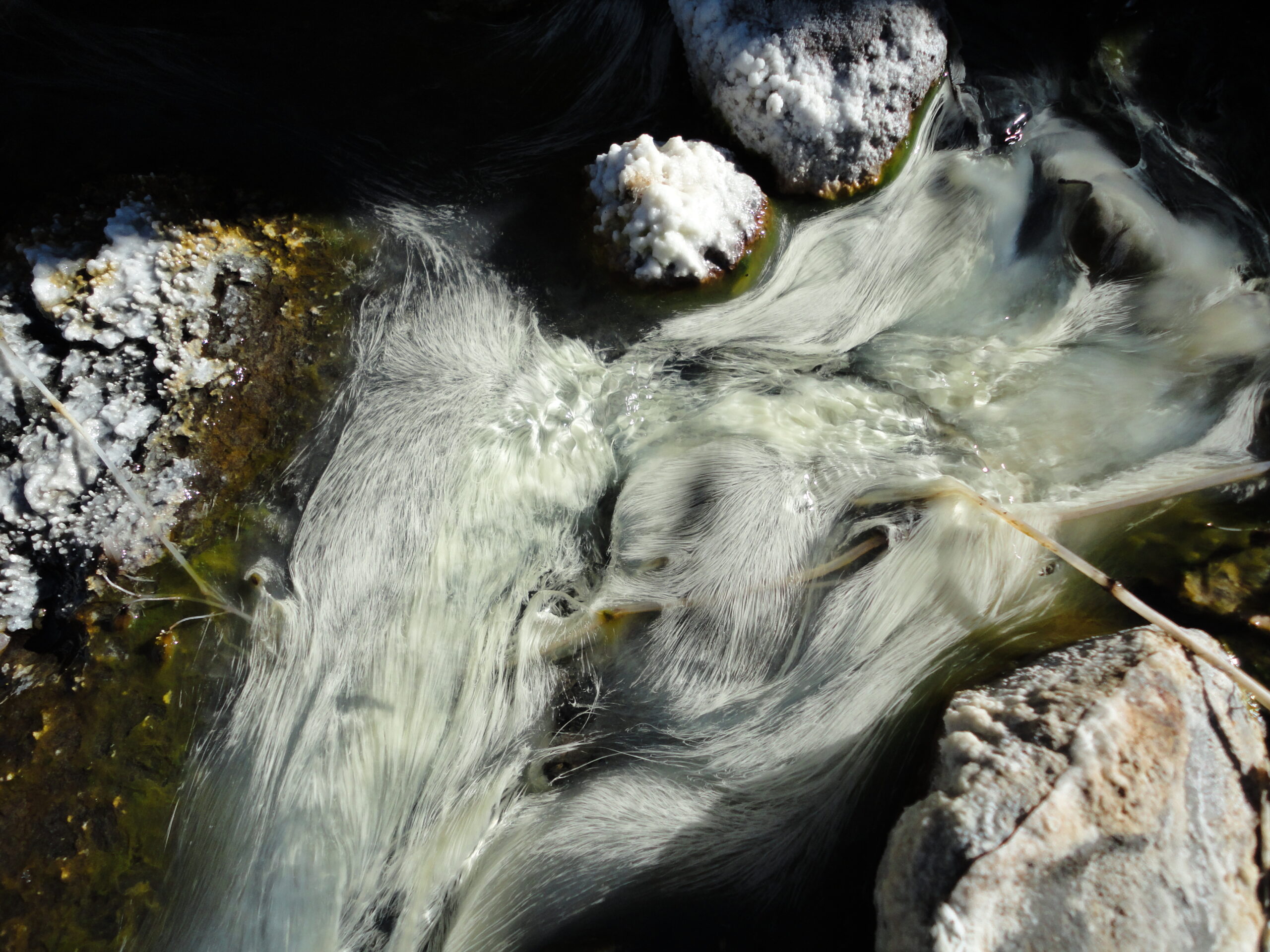
There are many species of extremophiles in the hot mineral waters of the Cascades, including in Big Bend hot springs. Scientists came to BBHS to filter lots of geothermal hot spring water to collect samples of the microbes living the the hot mineral water. They are looking for rare, unique, and undiscovered microbes that might have special DNA that can be altered in their lab and then tested for various potential uses, including breakthroughs in medical science such as synthesizing new drugs to treat currently untreatable or incurable illnesses.
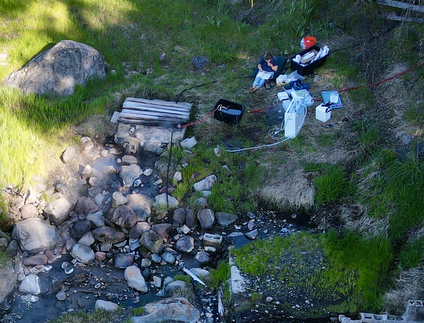
The giant crack in the Earth’s crust that runs deep under Big Bend and extends down towards our planet’s mantle makes for some very interesting science and there is a lot to learn! A geologist reported that the major fault line has several smaller minor fault lines that intersect with it and those smaller cracks spreading at various angles into the major fault makes it more likely for artesian hot springs to make it up to the surface. The Mother Source hot spring is located at the intersection of a minor fault line with the major fault line, and it is one of the most heat producing hot springs in California.
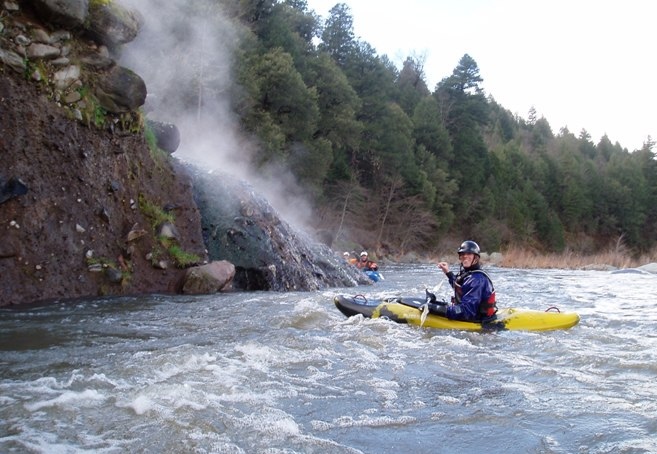
California (supposedly) has 305 hot springs, the second most of any state (Nevada has the most)! Since Big Bend is right in between two volcanoes and sits on top of the major geologic fault line there is a lot of hot water coming out of the Earth. Minor fault lines connect with the major fault line and that’s where the hot springs mostly exist. The main hot spring at Big Bend Hot Springs is right over the intersection of a minor fault line with the major fault line. That hot spring is called “The Mother Source”, and the water is scalding (180º F!), and is the 27th hottest hot spring in California (out of the 305 listed hot springs in the state).
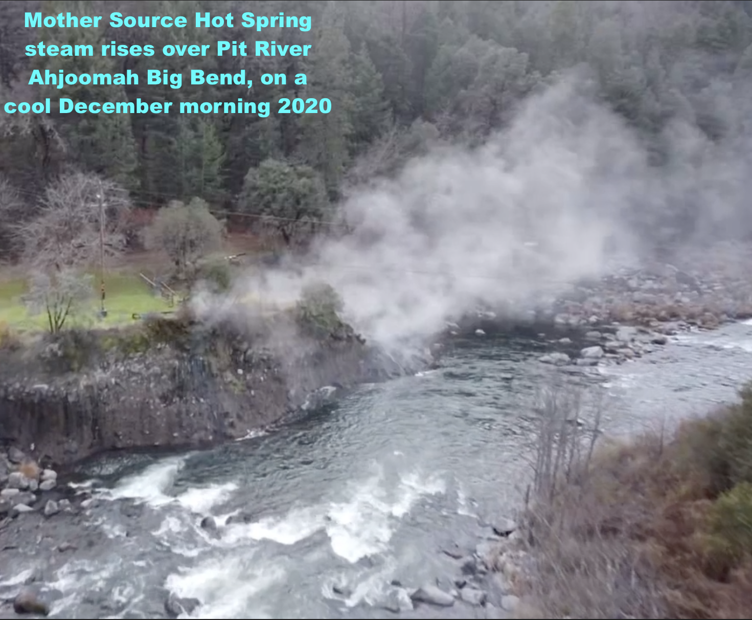
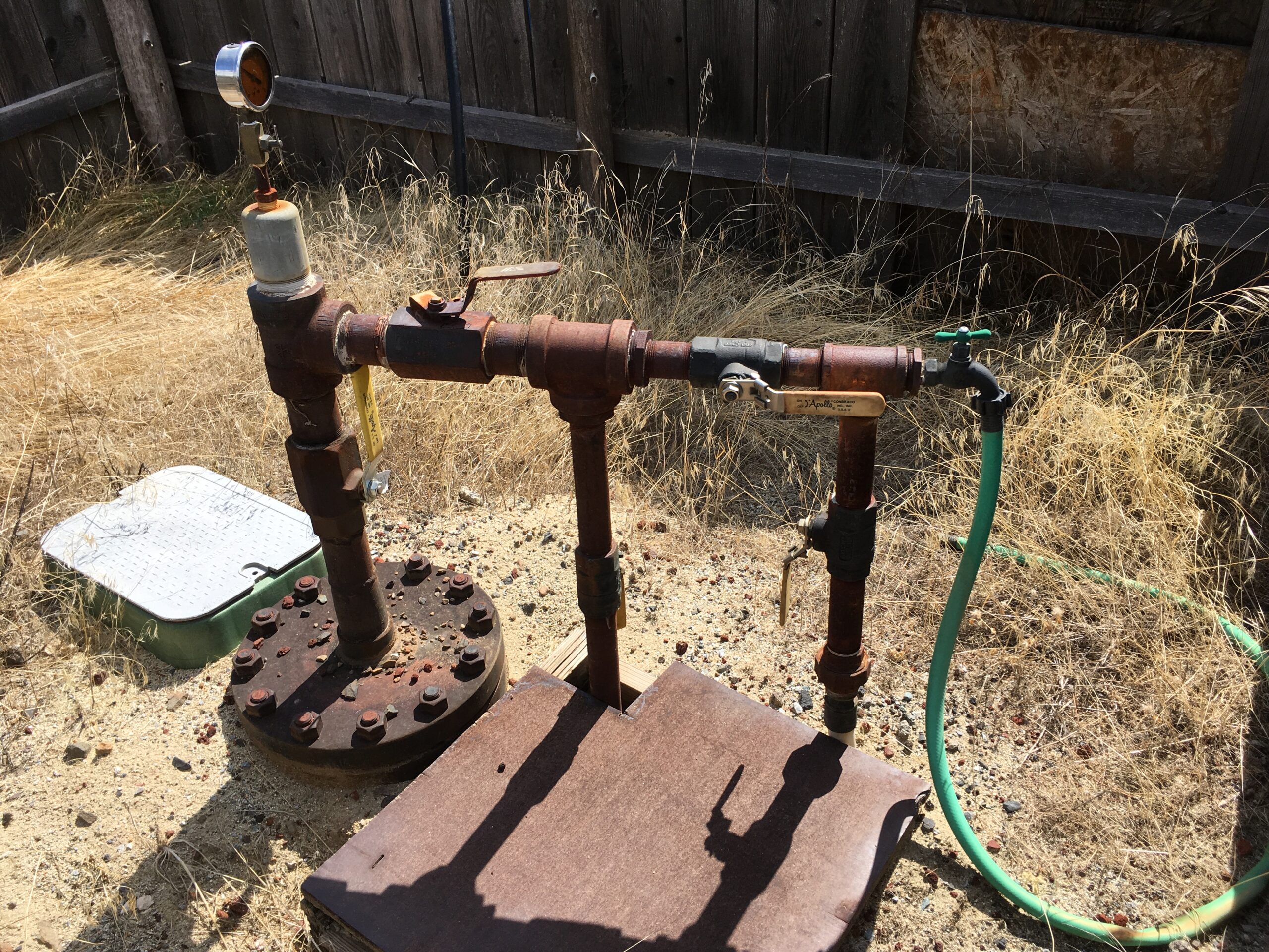
Also, Not to be Confused With Hot Springs: Human-drilled hot wells also exist in some parts of the Cascades, including in Big Bend. The hot wells are drilled into the hot aquifer that sits under the Big Bend part of the Cascades volcanic mountain range. The old Big Bend school campus has a hot well that was used to heat the building and the swimming pool (near the creek and over the same major fault line). The PSEA camp has a hot well used to heat their swimming pool.
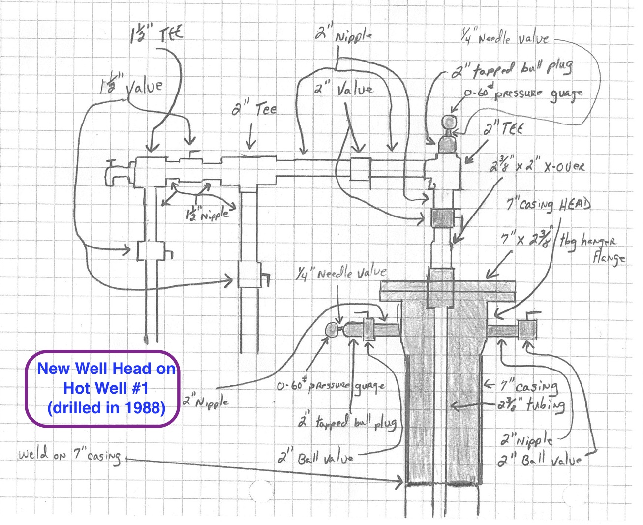
At least four hot wells in Big Bend were experimentally drilled in 1988 by a power company looking for steam to generate electricity. One of the four exploratory wells is 1200 feet deep and produces an artesian flow of 180ºF+ mineral water from the hot aquifer that has the same chemistry as the hot springs water. Water boils at 212ºF, so the Big Bend hot springs and hot well are considered “low temperature” (below boiling), even though they are scalding.
Hot Springs for Energy
Making Electricity From Geothermal Water: Newer hydrothermal generation system technology nowadays uses a working fluid that has a lower boiling point than water, so less heat is needed to drive a turbine to generate electricity. Big Bend Hot Springs Project has acquired a geothermal generator to make electricity from “waste heat”. When it gets hooked up, it will cool the mineral water down for soaking use while making a lot of electricity (10kW-20kW) with the captured heat, to use and sell leftovers to the grid! More information about this project is in several posts like this one on this web site in the list/menu of posts located on the right side of most web pages here (especially see the main post about this which is called, “Geothermal Power Plant“).
Medicine Lake Volcano
Not far from Big Bend, Medicine Lake Volcano is a very sacred place for local Native people, especially the Pit River Tribe, and is an important and fascinating part of the Cascades Geothermal stories… It’s a massive shield volcano and the largest volcano by volume in the Cascade Range, located about 30 miles northeast of Mount Shasta in northeastern California. It spans parts of Siskiyou and Modoc counties, features a summit caldera holding Medicine Lake, and last erupted about 950 years ago at Glass Mountain. The volcano is extends east of the main axis of the Cascade Volcanic Arc and the Cascade Range.
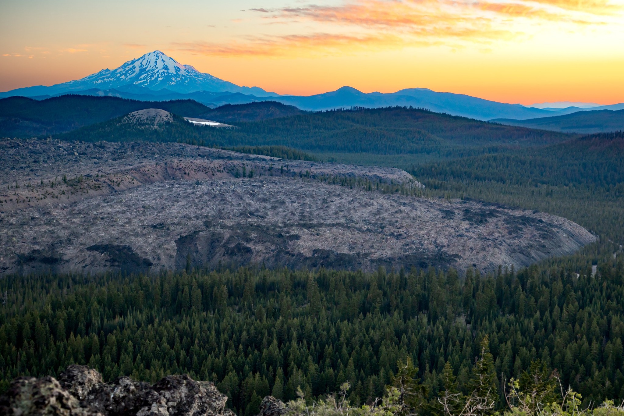
Great News: Medicine Lake Volcano holds significant high-temperature geothermal resources, but commercial development has been blocked for decades due to environmental and cultural preservation battles, and it was not federally protected until activists recently succeeded! Thanks to the Pit River Tribe and all other activists for all the decades of hard work to protect and preserve Sáttítla and beyond!!
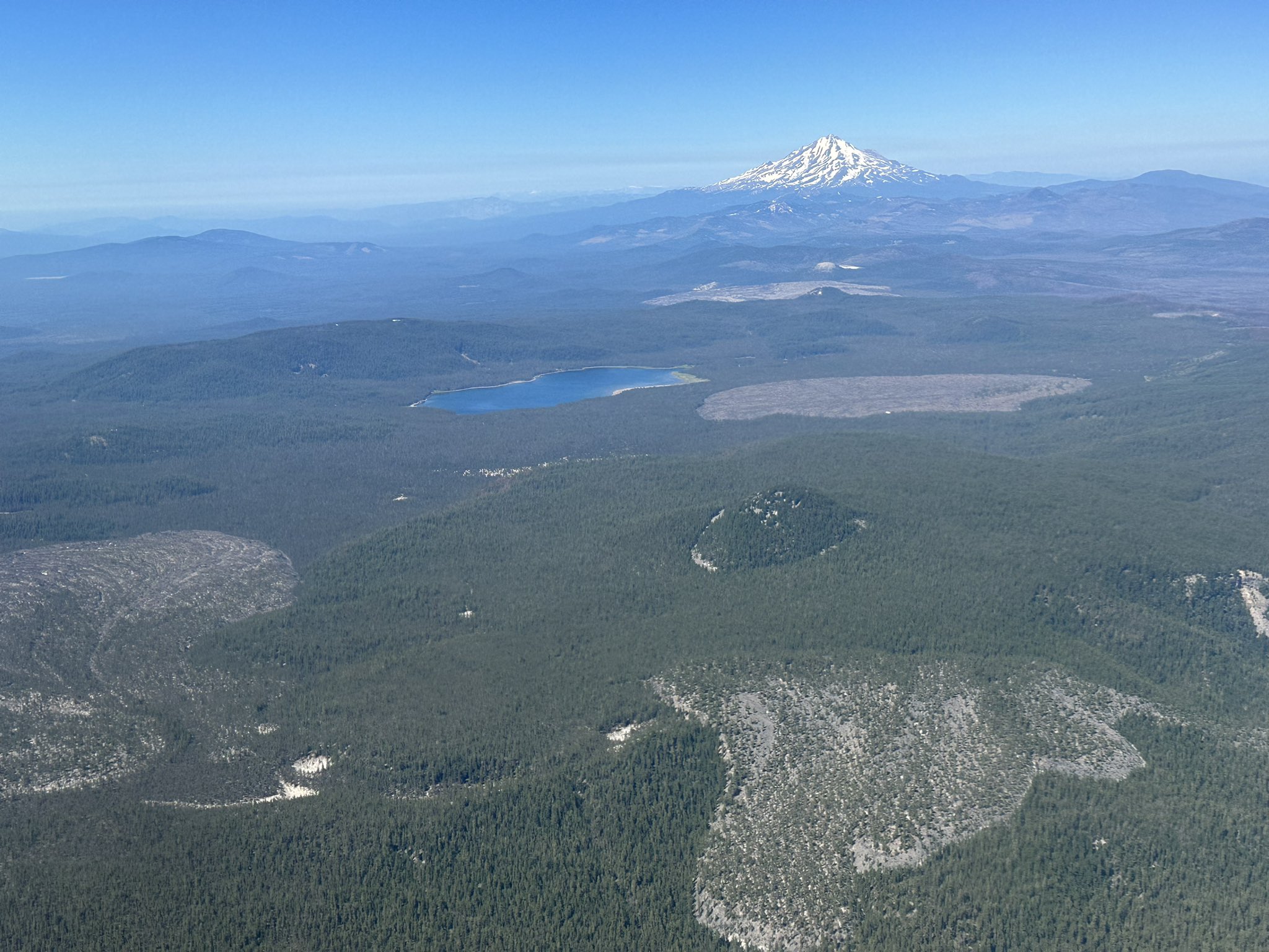
Both Medicine Lake and Glass Mountain are part of a federal National Monument designation signed into law. They are included within the Sáttítla Highlands National Monument (historically referred to as the Medicine Lake Highlands), which was established by federal proclamation in January 2025. Key aspects of the area include its resource potential, cultural importance, legal status, tribal ancestral homelands, historic and scientific treasures, rare flora and fauna, and the headwaters of vital sources of water. We pray and demand that Sáttítla will be protected forever!
THANKS SO MUCH FOR READING THESE POSTS & PAGES!!